
K2 Base Camp Trek (20 – 11 July 2025)
K-2, 8611 meters at the summit is locally known as Choghori, the second highest mountain in the world. It has been highlighted for the adventure lovers to enjoy the magnificence and grandeur of it’s presence.
The K2 Base Camp and Gondogoro La trek is a popular adventure, this trek takes you through some of the most stunning scenery in the Karakoram Mountains, including K2 Base Camp, Gondogoro La Pass, and the Baltoro Glacier.
K2 Base Camp and Gondogoro La Trek, interesting and challenging trek for the passionate trekkers. It brings you landscapes where four 8000 m peaks give us a breathtaking view. It is one of the most famous and impressive trek routes in Pakistan.
We start our challenging trek from Concordia over to Gondogoro La. Nanga Parbat Adventure team will place the ropes on the route up and down. You need to have mountaineering skills to cross this technical pass. The mountain view from the top is superb. We see the slender lines of Leila peak on the Hushe side. On the other side,
During our trek we will see the Trango Towers, Muztagh Tower, Masherbrum, K2 and Broad Peak among many others K-2, Broad peak and many peaks of the Karakoram mountains.
Usually, most of flights departure on afternoon and the flights will be land in Islamabad the next day in the morning in Islamabad.
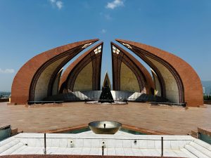 Arrive in Islamabad and transfer to the hotel. In the afternoon we enjoy a city tour of Rawalpindi and Islamabad. Overnight at Hotel.
Today we take the short but spectacular flight to Skardu. The flight time will be 60 minutes. Arrive and transfer to hotel. Overnight at Masherbrum hotel or k-2 Concordia Motel.
Free/preparation day in Skardu (Today we enjoy a free day in Skardu where we can visit the bazaar and Khurpucho Fort). Overnight at Masherbrum hotel or k-2 Concordia Motel.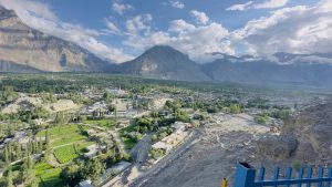
Note: If our flight canceled on day 2, than we will use the day 3 to fly from Islamabad to Skardu, in this case we will not have a day (3) free in Skardu.
Drive 6-7 hrs 129km. Alitude 3000: + 772m
Today we take the spectacular drive by jeeps to Askoli 129km drive time 6-7hrs, 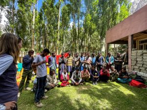 the starting point of our trek. Altitude 3,000m.It is a spectacular drive from Skardu to Askoli, the jeep road crosses the Braldu River three times and passes the villages of Dassu, Apligon, Pakora, Hoto Chongo and Thongal. Overnight in tents.
Trek to Jhola 6-7hrs 12.6km. Altitude 3,200m. + 200m
The early morning light finds us beginning our K2 Base Camp & Concordia trek as the Loads are distributed among the porters. Walking along the Braldu River. It takes 3 to 4hrs from Askoli to Korofoung. After lunch, continue to trek to Jhola (3-4 hrs) you have a panoramic view of Bakhor Das peak 5809m) also mighty Biafo Glacier. Follow the riverside trail to the confluence of the Biafo and Dumordo rivers. Cross the formidable Domordo River at Jhola which flows from the Panmah glaciers. Overnight in tents.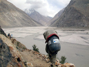
Trek to Paiyu 6-7-hrs 16.6km. Altitude 3,450m . + 250m
This is an undulating walk, difficult at times, with the first views of dramatic mountains ahead. There is a rest stop by some tamarisk trees beside the stream flowing down from Paiyu Peak, where we saw ibex tracks and fox spore. The trail climbs to a vantage point from which you see the snout of Baltoro Glacier and, in the far distance, a magnificent panorama of the Cathedral and Trango Towers and left of them, the unmistakable triangle of K2. Overnight in tents.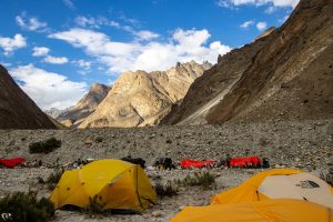
Free day for local exploration and Porter will prepare their food for further K2 Base Camp & Gondogoro La trek, We enjoy a slow start today taking in our stunning surroundings. We take a short acclimatization trek during the day and in the evening sing and dance with the porters. 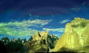
Trek to 5-6hrs 10.8km. Altitude 3,990m: + 540m.
On our way to K2 Base Camp Trek, our clients will have a nice view of Paiyu Peak 6610m, Uli Biaho 6417m, Great Trango Tower 6286m, Lobsang Spire 5707m & the Cathedral Towers. Overnight in tents.
Trek to Urdukas 3-4hrs 5.1km. Altitude 4,050m: + 60m.
Beautiful views of Great Trango & Uli Biaho Towers. The trail traverses the glacier angling gently towards its southeast margin. Exit the glacier into the ablation valley at Liligo. The route alternates between the lateral moraine and the glacier, heading out on the glacier to avoid the outflow from the advancing Liligo glacier. Continue trek to Urdukas, named for the obvious split boulder. Camp with its extraordinary views of Paiyu Peak 6610m, Uli Biaho 6417m, Great Trango Tower 6286m, Lobsang Spire 5707m & the Cathedral Towers. Overnight in tents.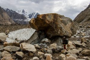
Trek to Goro-II 5-6hrs 12.1km. Altitude 4380m: +330m.
We will have a spectacular view of Masherbrum 7821m, Muztagh Tower 7284m, Biarchedi 6,781 Gasherbrum-IV 7925m. Overnight in tents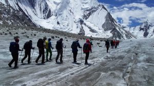
Trek to Concordia 4-5hrs 9.2km. Altitude 4,650m: +270m
Today it is golden opportunity to see 7000m to above 8000m peaks including mighty K2 (8611m) Broad Peak 8047m, G-I 8068m, G-II 8035m Sia Kangri 7422m, Muztagh Tower 7284m, G-IV 7925m, Miter Peak 6025m Golden Throne 7240m. Overnight in tents.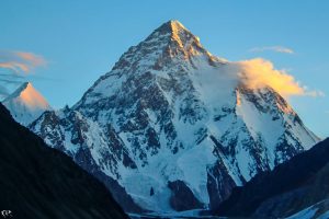
Day trip to Broad Peak & K-2 base camp Full day Excursion 8-10 hrs (Altitude 5,135m) + 485
Today it is golden opportunity to see 7000m to above 8000m peaks including mighty K2 (8611m) Broad Peak 8047m, Gasherbrum-I 8068m, Gasherbrum-II 8035m Sia Kangri 7422m, Muztagh Tower 7284m, Gasherbrum-IV 7925m, Miter Peak 6025m Golden Throne 7240m. Afterwards we continue on to K2 Base Camp (5,135m) . Excursion to K-2 base camp and explore the beautiful countless peaks around K-2, in the evening trek back to Concordia for overnight. K-2 is locally known by the name of “Chogori” which means “ The Great Mountain “ 8611m, is the 2nd highest mountain in the world. K2 is placed on the Pakistan-China border in the mighty Karakorum Range. K-2 is rocky mountain up to 6,000m, beyond, which it becomes an ocean of snow. K-2 was firstly discovered and measured by the survey of India in 1856, and first named for English topographer Henry Godwin-Austen, who explored and surveyed the region and it, was firstly climbed on July 31, 1954, by Italian climbers’ team led by Ardito Desio and accompanying him were Lino Lachdelli and Achille Compagnoni. For the night we will returnd to Concordia at camp.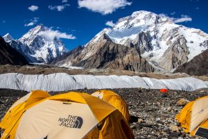
Trek to Ali camp 9.5 km 4 to 5 hrs. Altitude 5,010m. +360m
The first two hours of the trek are difficult as we leave the Concordia and traverse the Baltoro Glacier and its crevasses. It’s a comparatively easy and gradual walk over snow and ice, Mighty Chogolisa (7665m) stands guard in the south. Ali Camp (5010m) a combination of small rocky platforms between the cliff Face and crevasse. We turn in early, as we have a midnight wake-up call for the departure over the Gondogoro La. Overnight in tents.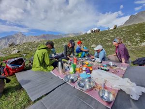
Trek to Hispung after crossing the Gondogoro La . 8km. 5,680m. Altitude 4522m 9-10 hrs. Loss: -410m.
We leave camp at about 1:00 am to climb the Gondogoro La (5680m). For the first two hours, we walk on the lateral moraine to avoid crevasses. As we get closer to the pass we shift on snow until the base of the pass. The final ascent involves a steep walk on snow and, depending on conditions, the use of fixed ropes as well as crampons and ice ax. The views from the top of the pass are unparalleled, with K2, Broad Peak, Gasherbrum I to IV, Masherbrum, and many other mountains appearing at our level. The descent on the Hushe side is steeper, requiring good balance on the rocks. Overnight in tents. 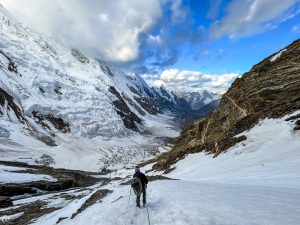
Trek to Saicho 5-6 hrs . Altitude 3,330m. loss – 1,260 m
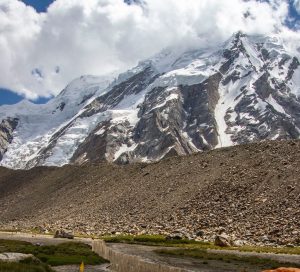
We gradually leave the icy landscapes and descend to the meadow and pastureland at Saicho (3330m ). Although we’ve left the icy wilds, we still have tremendous views of the mountains, including Namika Peak and Defokhar (21,464 ft.). Overnight in tents .
Trek to Hushe 4-5hrs 9.3km. Altitude 3,050m. loss-280m.
Descend to the Gondogoro River, enjoying spectacular views of K6 (23,881 ft.), K7 (22,744 ft.) and Link Sar (23,094 ft.). We continue to descend, passing through small summer settlement en route to the green irrigated fields at Hushe (10,500 ft.), The Hushe valley runs from 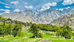 Masherbrum Mountains (at 7821 meters) the 24th highest in the world, first climbed by the American in 1960. South to the Shyok River, opposite Khaplu, Hushe, the last village up the valley, is about 140 kilometers east of Skardu and is the starting point for treks to various summer pastures up five glaciers. Overnight in tents.
Day 18 is free day, in this free day we can either Trek to the have the view of K2 from Homebrok 6 – 8 hrs trekking.
(OR)
Trek to view point of mashabrum glacier 6 – 7 hrs of trekking
Drive to Skardu (6-7 hrs) 180 km. Alitude 2,228 m. loss 822m.
Drive on the 4×4 jeeps to Skardu. Overnight at Mashabrum hotel or k-2 concordia motel. Loss:-822m.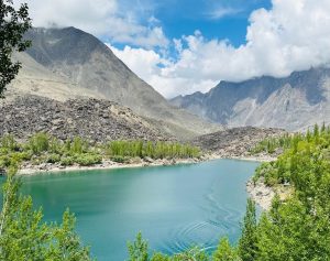
Fly to Islamabad [flight is subject to weather] in case of flight cancellation we will wait for the next day flight.
Taxila: Most of the archaeological sites of Taxila (600 BC to 500 AD) are located around Taxila museum. For over one Thousand-year Taxila remained famous as a center of learning Gandhara art of sculpture, architecture, education, and Buddhism in the days of Buddhist glory. There are over 50 archaeological sites scattered in a radius of 30 km around Taxila. In Taxila visit archaeological sites of Jaulian, Mohra Moradu, and Sirkap. It is one of the best and well-maintained site museums of Pakistan. Overnight at Hotel.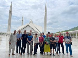
Note: If our flight canceled on day 20, due to bad weather, than we will use the day 21 to fly from Skardu to Islamabad, in this case we will not have a day ( 21) free in Islamabad.
After a long and hard trekking and journeys we will take a long sleep. After breakfast we will be ready for sightseen of Islamabad, visiting the Log Virsa Museum where you can experience all four province culture, way of life and the strong cultural interaction with neighboring countries of Pakistan, later we will give time to walk around the bazars. In the evening will have all together farewell dinner from Nanga Parbat adventure at Monal restaurant on the Margala hills. Overnight at Islamabad Hotel or Envoy continental.
Transfer to Islamabad airport for international flight.

K-2, 8611 meters at the summit is locally known as Choghori, the second highest mountain in the world. It has been highlighted for the adventure lovers to enjoy the magnificence and grandeur of it’s presence.
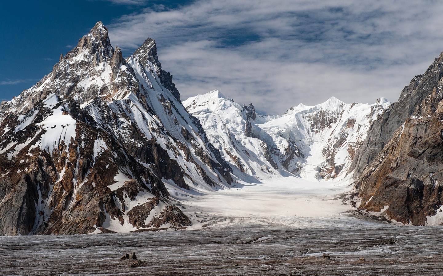
Biafo & Hispar Glaciers have a total length of 126 km and are the longest of their kind outside of the Polar Regions. They meet at the 5,150 m high Hispar Pass. This immense highway of ice and rock connects the antique kingdoms of Nagar in the West and Askoli (little Tibet) in the East.
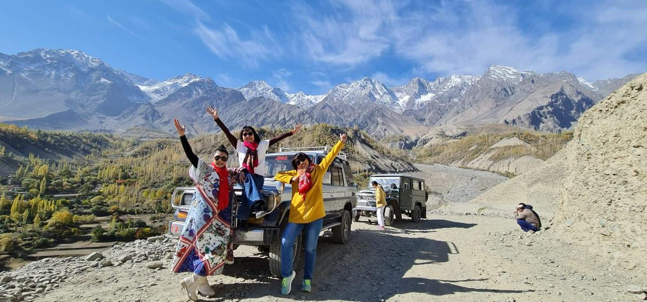
Karakoram Jeep Safari tour take us Karakoram Highway, eighth wonder of the world, is a unique highway that provides one of the most adventurous and scenic journeys to many parts of F.A.N.A (Federally Administered Northern Areas).
Nanga Parbat Adventure tourism company is founded in 1999 and registered with Ministry of Tourism, Govt. of Pakistan.