Biafo Hispar Snow Lake

Biafo & Hispar Glaciers have a total length of 126 km and are the longest of their kind outside of the Polar Regions. They meet at the 5,150 m high Hispar Pass. This immense highway of ice and rock connects the antique kingdoms of Nagar in the West and Askoli (little Tibet) in the East.

This route was extensively used to connect the Silk Route with the Indian Sub-Continent, China and Tibet. Mr. H.W. Tilman, an English trekker, claimed in 1937 that he had seen the footprints of Yeti on the glacier.

The same way served the people of Hunza to invade Askoli. Later it was used as a more progressive way between Hunza and Askoli and the people of Hunza came over to Askoli to play Polo with them.

This life-long trekking experience ends at the beautiful Hunza Valley, the Valley of Eternal Youth and home of the most progressive people compared with other parts of the Northern Areas. The people of Hunza are known for their longevity. In Karimabad we visit Altit and Baltit Fort and enjoy the unforgettable view from the roof-top of Baltit on Rakaposhi and Diran. Glaciologists after conducting tests on the Snow Lake confirmed that the thickness of snow is one mile. Here one can observe the rare species of animals in abundance like Snow Leopards, Himalayan Bears, Ibex, Markhore and some times the Marco Polo Sheep.

Itinerary

Day 1: Rawalpindi / Islamabad

Depart From Your Home Country

l
Day 2: Rawalpindi / Islamabad

Meeting upon arrival at Islamabad airport and transfer to hotel. After lunch, sightseeing tour of twin cities of Rawalpindi and Islamabad, which includes a visit to the Folk Heritage museum, World biggest mosque The Shah Faisal Mosque, Shakir Parian , Daman e koh for taking a bird eye view of Islamabad. Evening return to hotel for overnight. Breakfast included.

Day 3: Fly to Skardu Or Drive to Chilas

We go to the domestic terminal at the airport and take the spectacular flight across the mountains to Skardu. The rest of the day is free. Should the flight not operate because of the bad weather or some other reason than we shall drive, a long journey up the Karakorum Highway to Chilas, but compensated by the impressive scenery. On arrival to Chilas transfer to Hotel. 460 Km, 10/12 Hours.

Day 4: Day Free at Skardu or Drive Chilas to Skardu

A free day in Skardu during which several excursions can be made, about 4 miles away is the Satpara Lake or the climb to the top of the Skardu rock will reveal the remains of a fortress built some 150 years ago, which has superb views of the Shigar and Indus valleys. If yesterday’s flight was cancelled then this day is spent on the road driving from Chilas to Skardu, on arrival transfer to Hotel. Approx. 8/10 hrs.

Day 5: Drive to Askole (3000m)

We set off northwards of the Shigar valley to Askole, which used to be the end of the road, where we leave our jeeps and we start walking. The last part of this jeep road may be in a bad state of repairs and it may be necessary to start walking a little before Askole. camping. Overnight in tents. Approx. 7/8 hrs.

Days 6: Trek to Namla

As loads are distributed among the porters in the early morning light, we start our trek entering an incredible wilderness of rock, ice and sky. Walking along Braldu river, we pass through the village of Askole after about an hour. This is the last permanent settlement along the trek. Another three hours walk brings us to Biafo glacier, two kilometers wide at this point, and our companion for the half part of the trek. We set foot on the glacier and scrambling across the boulders of lateral moraine for about three hours, we arrive at Namla campsite at 3400 m. Approx. 6/7 hrs.

Day 7: Trek to Mango

Trek to Mango along the Biafo glacier. Much of the walking will be done on the glacier or its fringe and all human habitation is quickly left behind in this desolated landscape. Trekking in the heart of Biafo Glacier we will reach Mungo, where yak herders from Askole live during the summer. It has beautiful green grassy grounds . Camp at Mango (3650 M). Approx. 3/4 hrs.

Day 8: Trek to Baintha

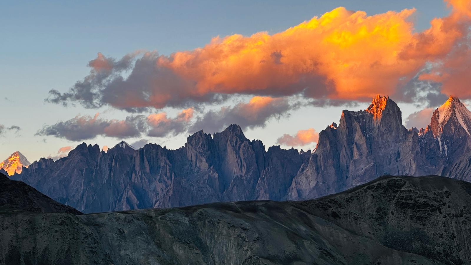
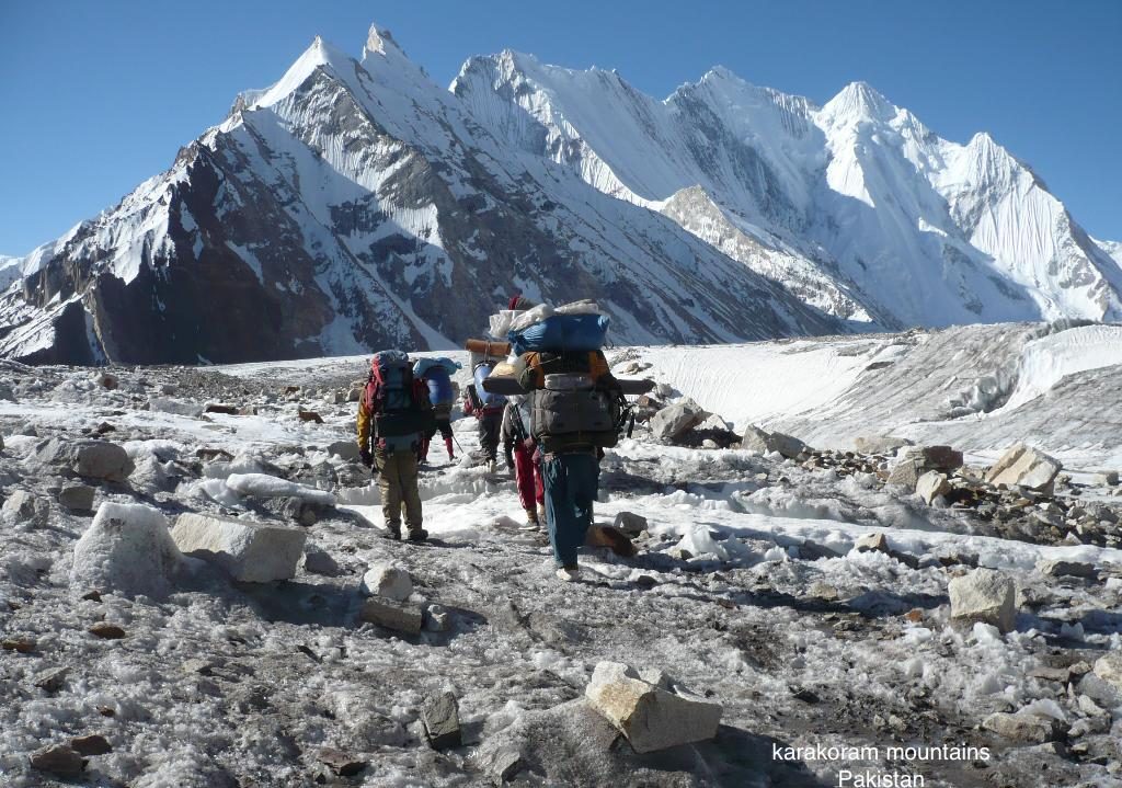
Latok group of Peaks are Latok I is 7145m, Latok II is 7108m Its west face first ascent made by Toni Gutsch, Alex and Thomas Huber in 1997 (a recent Italian expedition surveyed the Latok peaks and measured Latok II higher than Latok I),Latok III 6940m, Latok IV 6456m, Latok IV SE Ca6450m. The other peaks close by are Choktoi 6166m, Baintha Brakk SE 6960m, 7285m middle, Orge Thumb / Lukphila Brakk 5500m, Spaldang 5590m, Biacherahi Towers 5900m. Big Wall is the nature phenomenon, a precipice which has a steep more than 70 degree and the length more than a kilometer. There are 20 Big Wall in the World and Latok is one among them. Latok peaks are mixture of ice and rock climbing. Not all of Latok Peaks faces are climb, there is plenty of opportunity for adventure lovers to come and make their first ascent. In 1999 the Huber brothers from Germany made the second ascent on Latok IV south 6450m in one day they also climb Latok II.

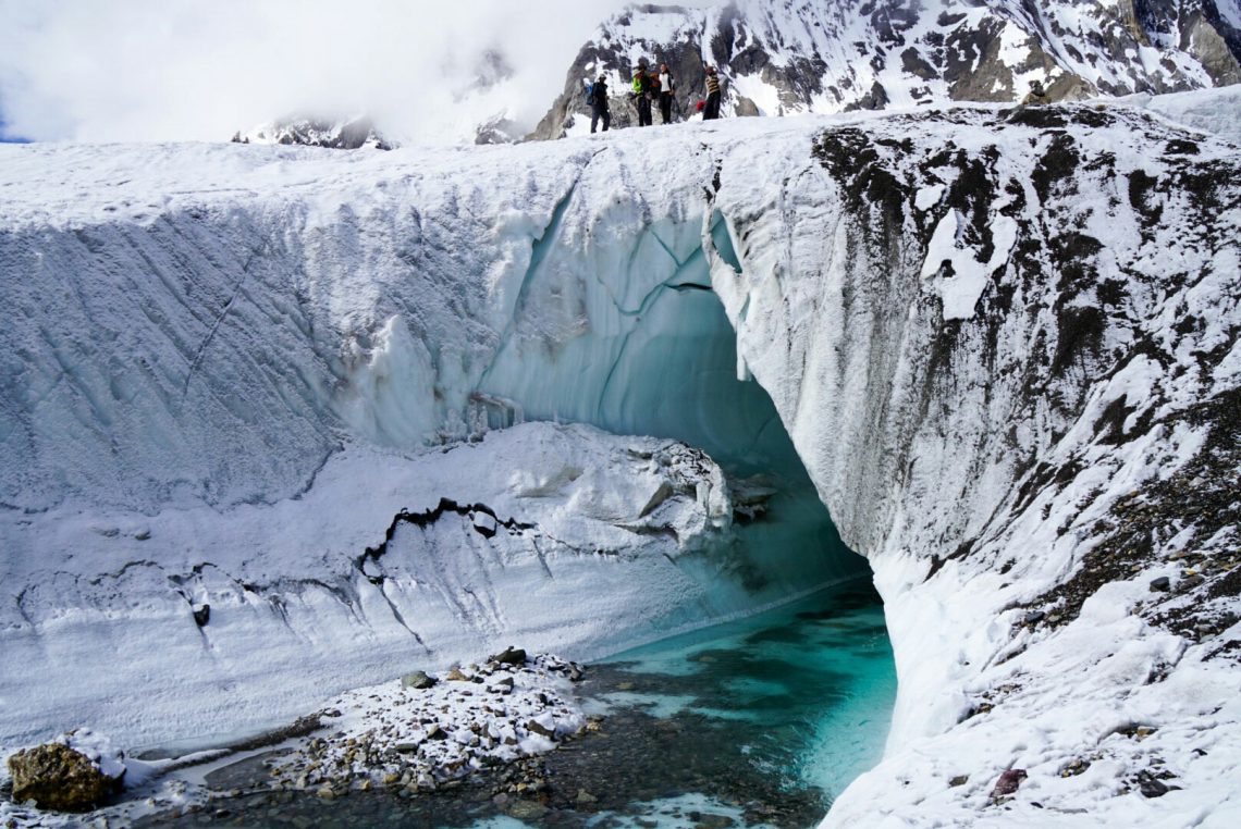
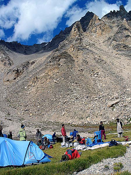
Baintha is the local name for Ogre, this is an easy day walking on the glacier. Hispar Pass can be viewed while walking. Enjoy spectacular views of Latok groups of Peaks including Latok 1 (7,145 m), Latok 2 (7,108 m) along the trek. The track follows the ablation valley past a small lake, then heads out across the lateral crevasses to the smooth white center of Biafo glacier Biantha campsite is grassy area with clear stream flowing through dense willow shrubs surrounded by Himalayan flowers. Sir Martin Conway one of early exploratory visitors camped here in 1892. Baintha camp is at 4000m above sea level. Approx. 4/6 hrs.

Day 9: Free Day

Free day for acclimatization.

Day 10: Trek to Karfogoro

The first hour of the trek is lovely walk along the ablation valley, crossing many small lakes surrounded by willow bushes and wild flowers. This area is habitat of bears and Himalayan Ibex, as you can guess from their droppings along the trek. Once on the glacier the walk is gradual climb over smooth ice. In case of fresh snow on the glacier, we must rope up and walk with a flying belay. Enjoy challenging views of Sosbun Brakk (6.418 m). camp at 4400 meters. Approx. 7/8 hrs.

Day 11: Trek to Snow Lake

This a steady walk on snow covered ice. Today we shall rope up to avoid the danger of snow bridged crevasses. You are on the edge of Snow Lake. This lake has depth of I mile as per the latest research. Pre-dawn departure from the camp will enable us walk firmly over the soft snow on the medial moraine. After two hours steady plod we arrive at the intersection of Sim-gang glacier with Snow lake. We camp at around 4,780 meters, at the western border of Snow Lake close to Hispar Pass. Approx. 2/3 hrs.

Day 12: Free day to explore Snow Lake

Optional walk to explore the vast snow lake from where several treks lead to Shimshal. We may come across the rare species of snow leopard here.

The name Snow lake was given by martin Conway in 1892, who has given dramatic account of this place in his book ”Climbing expeditions in Karakorum – Himalayan”. Eric Shipton in 1937 had estimated the present size of the Snow Lake 77sq. Km.

Day 13: Trek to base of Hispar Pass

Setting out at first light we cross the vast expanse of Snow Lake before starting a gradual ascent to our camp on the Hispar La.

Day 14: Cross Hispar Pass 5151m to Khanibasa

Early morning departure from the camp for climbing the pass. Gaiters are essential as snow can be deep even in the morning. We walk in single file with rope between us. The route passes through the center with giant crevasses and striped, greenish blue seracs on either side.

The view of Snow lake from the top of Hispar pass 5,151 m, inspires feeling of wide open snowy place. Numerous glaciers emerge from the Snow lake and disappear between nameless Virgin Karakoram peaks.

The Highest of these peaks is Baintha Brakk (7,285 m) also called Ogre, first for Chris Bonington and Doug Scott in 1977. On the other side of the pass, snow covered Hispar glacier stretches as far as eye can see, with white pyramid of Workmann Peak (19,300 ft.) in North. We descend down and camp on the northern moraine of glacier, at 4580 m. Descending to Khanibasa again requires you to be roped. Approx. 7/8 hrs.

Day 15: Trek Khanibasa – Yutmaru

Soon after walking from the camp we cross Khanobasa glacier that takes around one and a half hour. Enjoy spectacular views of Kanjut Sar (7,700 m), the 29th highest peak in the world. Now trek follows lateral moraine with exciting views across to the hanging glaciers and frequent avalanches on the southern ice walls. Yutmaru at 4330 meters is a flat sheltered field in ablation valley, surrounded by willow bushes and flowers. It also offers a fine view in east of the Hispar Pass and Balchish range running from there to west. Approx. 5/6 hrs.

Day 16: Trek Yutmaru - Bitanmal

An hour’s easy walk through ablation valley brings us to Yutmaru glacier, that takes around two hours to traverse – with high ice walls and deep crevasses to negotiate. Once across the glacier, we climb up steeply over the cliff with a panoramic views back to Hispar Pass. As we descend along trek, we have views of Kunyan Chish Range(7,852 m), the 22nd highest peak in the world. The Pumari chish glacier flowing south from this mighty mountain has been pushed forward towards Hispar glacier since 1988. Walking on a path 100 meters above Hispar glacier, we arrive at our campsite at 3902 m. Approx. 6/7 hrs.

Day 17: Rest day at Bitanmal

Our campsite Bitanmal in ablation valley, is a wide open summer pasture surrounded by willows and flowers. In summer the shepherds from Hispar village come to live here with their herds of goats, sheep and Yaks. A perfect place to rest.

Day 18: Trek to Hispar

A lovely and relaxing walk through green pastures in the ablation valley past willow and cedar shrubs and herds of goats, sheep, cattle and donkeys. Soon we come across the south bank of Hispar river, a wide alluvial fan rippling in terraces down to a cliff above Hispar river. We cross a wooden bridge over the river and climb steeply to enter Hispar village, a combination of mud houses, apricot, willow & poplar trees, and fields of wheat, peas, beans – and always present wild poppies and marijuana. After spending some time here, we walk for another hour to our camp close by the roaring river at 3,200 meters. Approx. 5/6 hrs.

Day 19: Drive to Karimabad

In the morning there is a possibility we walk for two hours through the dry landscape to Huru settlement in case the road is blocked between Huru and Hispar villages. Board soft top 4×4 jeeps for short ride to Karimabad., the capital of Hunza valley, off the Karakoram Highway heading to China. You are never short of views here. Enjoy spectacular views of Rakaposhi (7,788 m ), Ultar 1 (7,388 m) Ultar 2, and Golden Peak. Afternoon free, meals and overnight at Hunza View Hotel. (2 hours trek & 3 hours by jeep). Full Board, all meals included.

Day 20: Free day in Karimabad and visit Forts

Day free at Karimabad to explore the valley and visit the Baltit and Altit forts. Altit & Baltit forts are the landmarks of the times when Hunza was a well sought after staging post on the Karakoram Branch of the Silk Route. The frost were erected by the locals of safeguard themselves against the invaders coming mostly from Central Asia, over the high passes.

Day 21: Karimabad to Chilas. 1265 m

Early in the morning we drive towards Chilas, on our way we will visit the Rock carvings near Chilas Thalpan after short visit of Rock carvings we will continue to Chilas. Drive 4 to 5 hr.  Overnight in Hotel.

Day 22: Chilas to Islamabad via Babusar

Today we have to wake up early in the morning as our distance is long, we will have breakfast and drive via Babusar pass (4 173m ) we will take a short stop and then continue our journey further. We will take our lunch break at Naran which is very popular touristic destination summer destination in Pakistan. After we will continue towards Islamabad. Overnight in Hotel.

Day 22: Departure

Morning transfer to airport for international flight

Gallery

Discover Pakistan

Trekking Tours

Shimshal Trek

Shimshal is the last remnant of true Hunza culture that exists near Pakistan’s Pamir range, east of the town of Passu in upper Hunza valley.

Deosai & Rupal Panorama

This unique and exciting trip will take you to one of the most scenic plateaus of Deosai at 3980 meters. Although this plateau is quite well visited by the foreigners and locals, but their visits are generally limited to roadside stops.

Ancient Wakhan Corridor

This is truly one of the finest treks offered within Hindukush Range in Pakistan, exploring an area visited by very few tourists as it has recently been opened for foreigners. We trek through the beautiful and scenic mountain villages in Chitral…