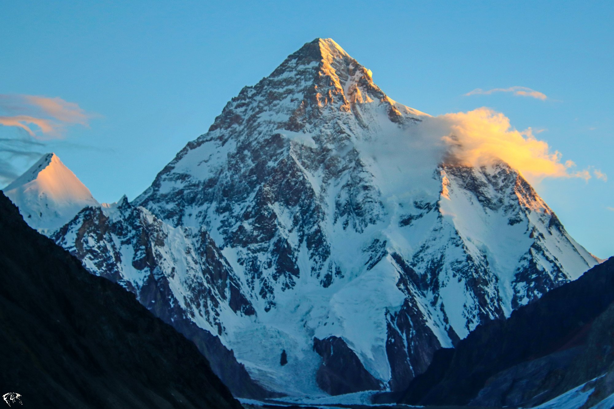
K2 Gondogoro La Trek 2026
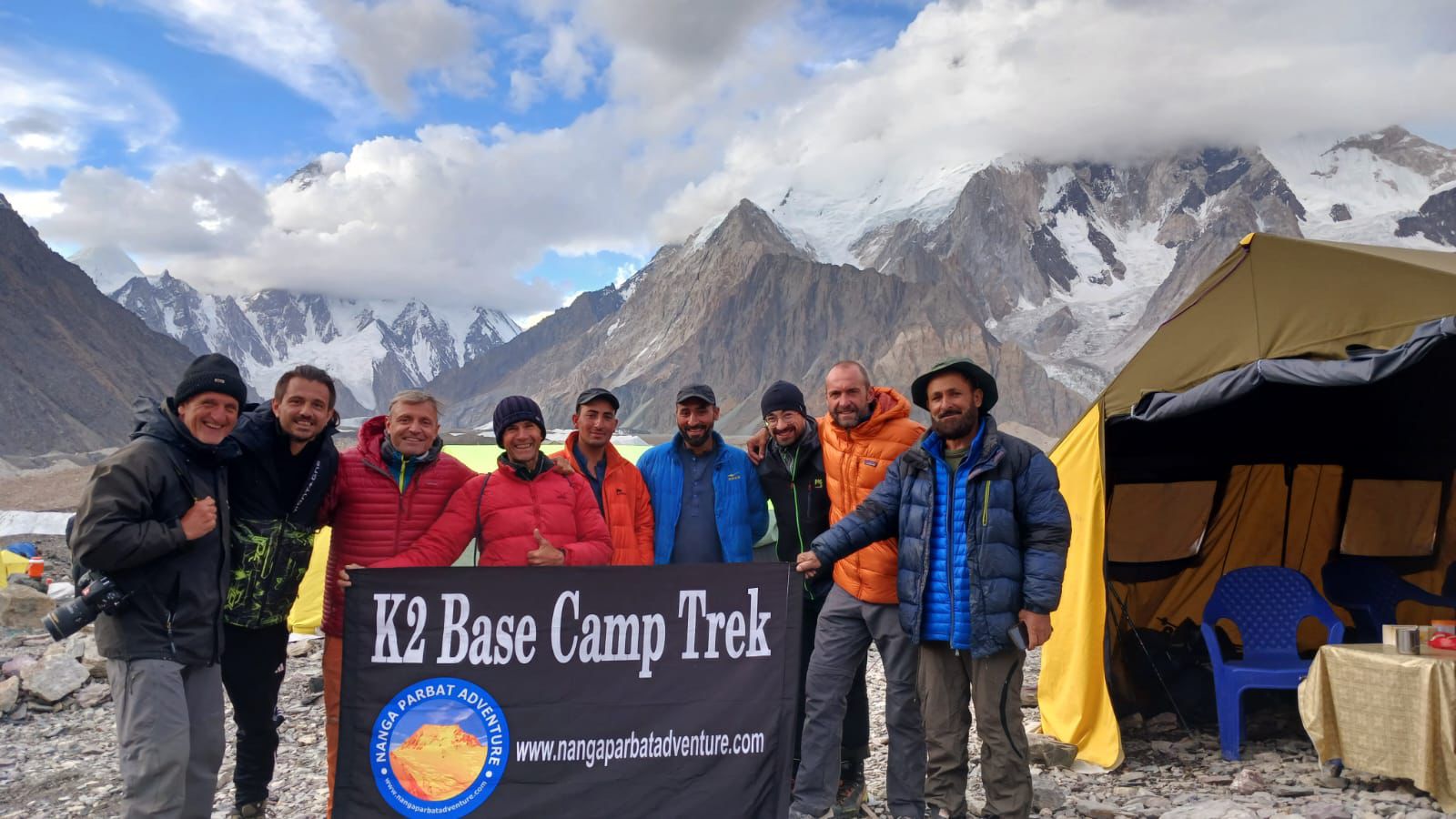
The K2 Gondogoro La trek is a popular adventure, this trek takes you through some of the most stunning scenery in the Karakoram Mountains, including K2 Base Camp, Gondogoro La Pass, and the Baltoro Glacier.
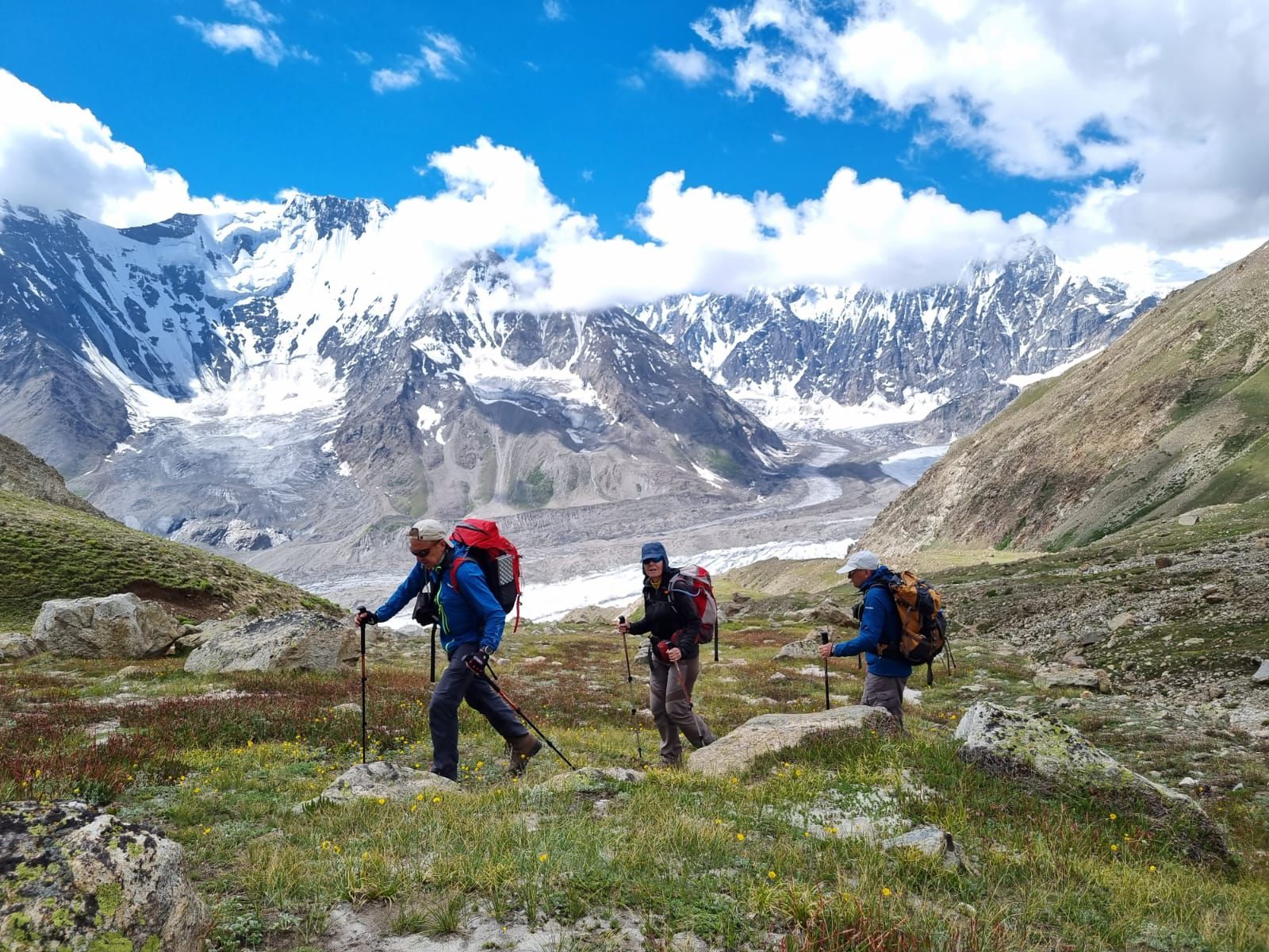
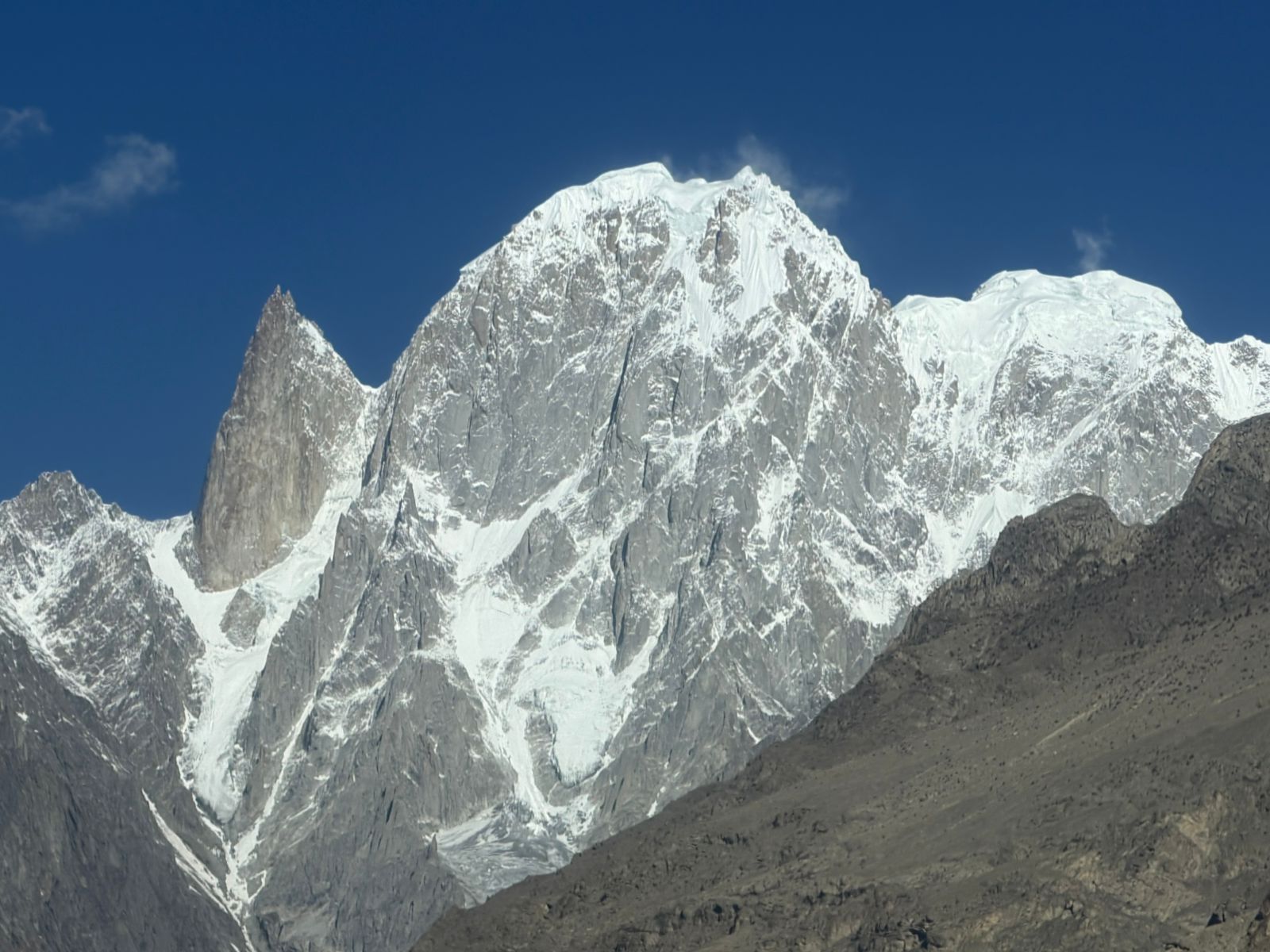
The Shimshal Pass Trek often called one of the most rewarding and remote adventures in northern Pakistan—is a journey through the breathtaking landscapes of the upper Hunza region in Gilgit-Baltistan. Starting from the high-altitude village of Shimshal, known as the “Valley of Mountaineers,” this trek takes you deep into the rugged heart of the Karakoram Mountains.
The trek usually leads to Shimshal Pass (also called Shuwerth Pass)—a sweeping plateau at over 4,700 meters—surrounded by towering peaks and serene lakes. It’s also a region famous for producing some of Pakistan’s greatest climbers, and the trail reflects their legacy of resilience and exploration.
Challenging yet immensely rewarding, the Shimshal Trek is ideal for those seeking an authentic, off-the-beaten-path mountain experience far away from commercialized routes. It offers not just stunning scenery but the feeling of stepping into a world where nature is vast, raw, and timeless.
Departure from home country
Welcome and check-in at the hotel. Visit the modern capital and the bazaars of the old city of Rawalpindi (national capital from 1959 to 1967). Immersion in the atmosphere of the Rajah Bazaar, smells, colors, animation and smiles, before the tranquility of the wide-open spaces and high peaks that awaits us in the coming days.
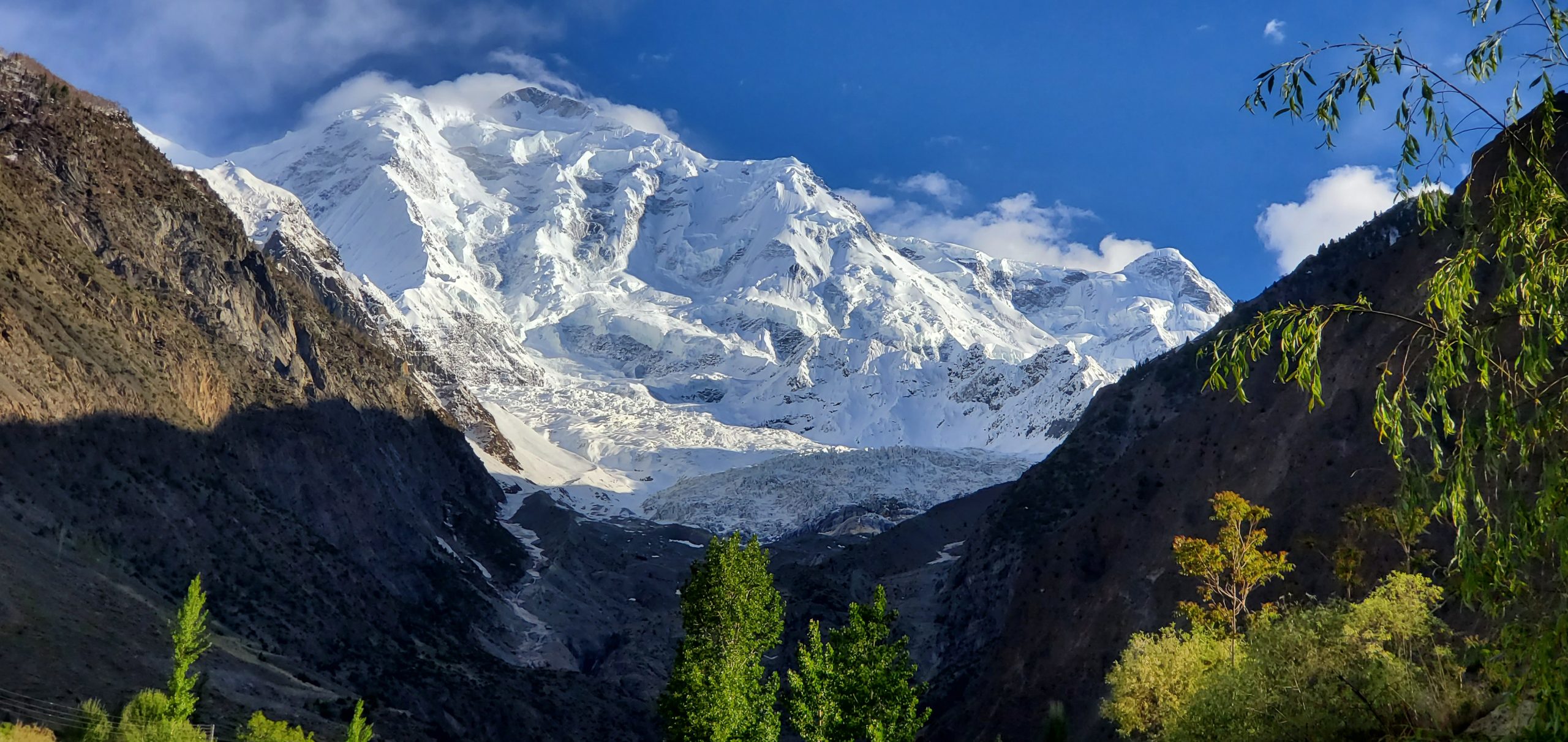
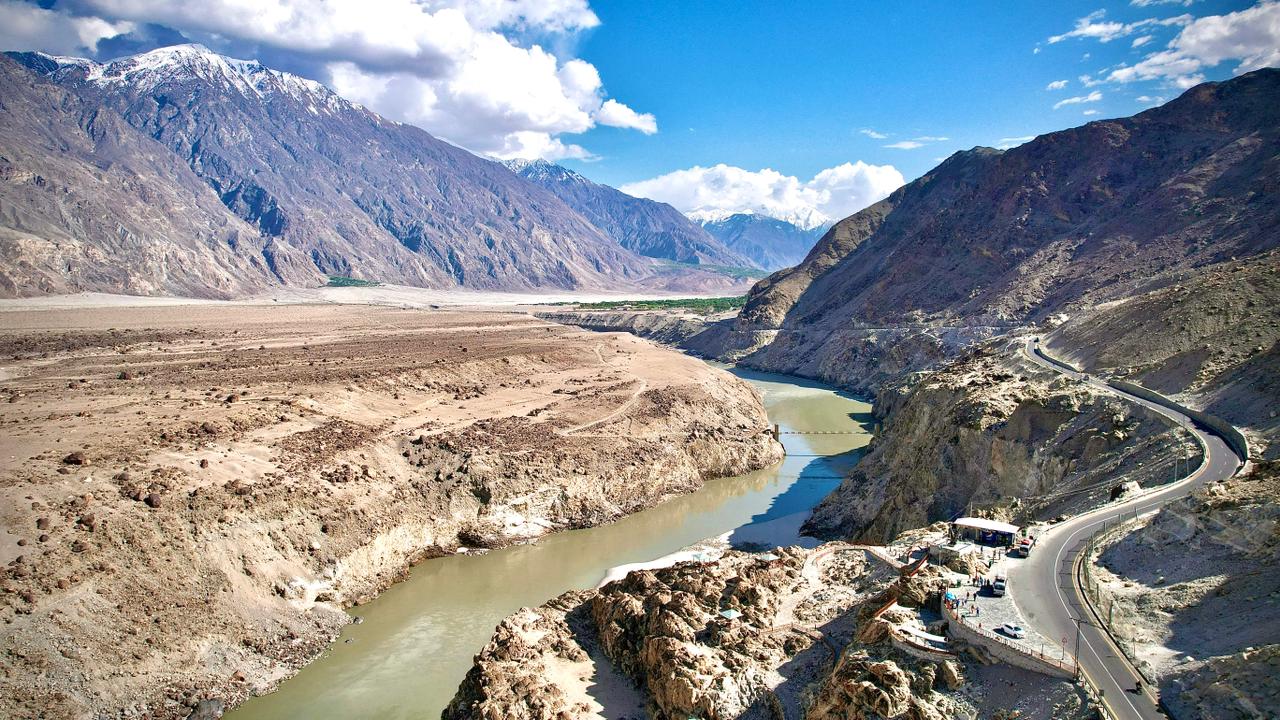
Transfer to airport: 1 hour flight and 4 hours’ drive. In the morning, enjoy a spectacular one-hour flight to the town of Skardu, in the heart of Balistan. Enjoy an exceptional panorama of Nanga Parbat (8,125 m), the ninth highest peak on the planet. Arrive in Skardu (2,228 m) and explore the surrounding area. After lunch, transfer to Juglot. The road runs along the right bank of the Indus River before crossing the Gilgit River.
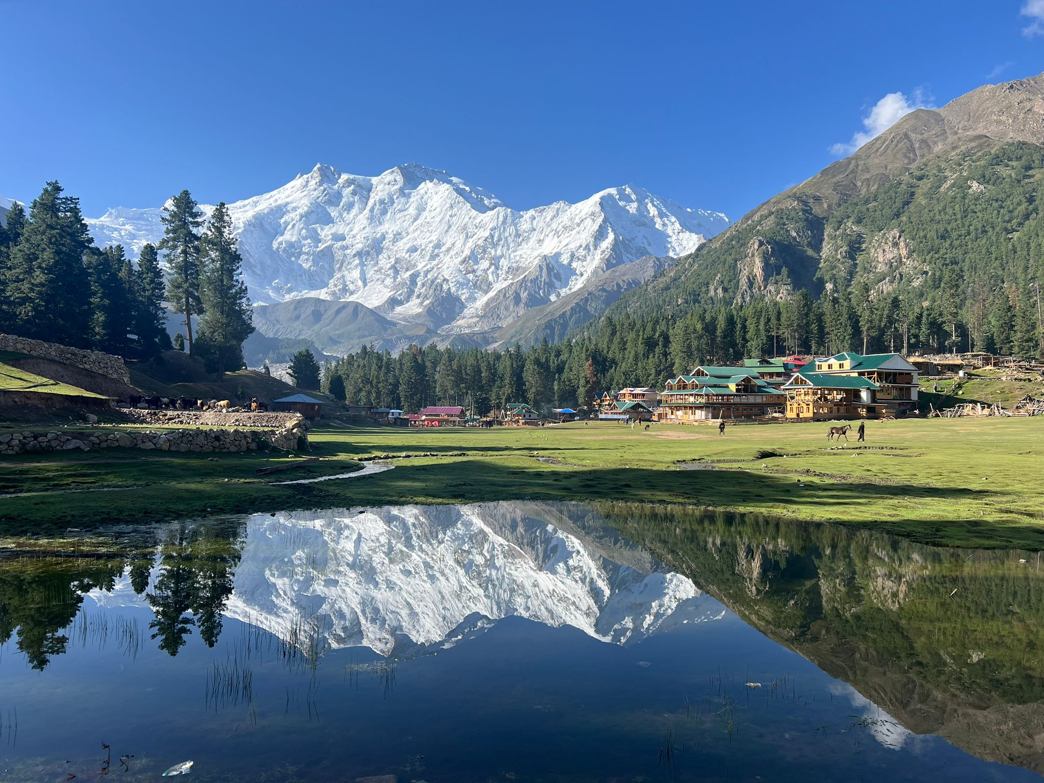
Early in the morning, short transfer (40 min) by bus to Raikot Bridge, then climb to Tato (2550m) by Jeep via an impressive steep, stony and narrow track. First steps on foot, “gentle” climb through a magnificent coniferous forest towards Bayle Camp via Fairy Meadows (the enchanted meadow), which lives up to its name. We reach a small green paradise (3550 m) offering a spectacular panorama of the north face of Nanga Parbat and the Raikot glacier. The mountains surround us and the pasture is bucolic, goats, sheep, cows and calf! Welcome to Pakistan! Installation in cottages for two people.
Elevation gain: 1000 m. Elevation loss: 100 m. 4 hours of walking.
Today we hike to Nanga Parbat Base Camp (3967 m) and the memorial to Herman Bull, the first ascent of Nanga Parbat. On the agenda are magnificent panoramas of the iconic summit (8126 m), but also of Raikot Peak, Chongra I and Ganalo Peak. Nanga Parbat means “naked mountain”, it is the highest in Pakistan. Due to the difficulty of its ascent and the accidents suffered by summiteers until the middle of the 20th century , Nanga Parbat is also known as “killer mountain”. Return either by the same route or in a loop crossing the Nanga Parbat glacier.
Elevation gain: 500 m. Elevation loss: 500 m. 5 hours of walking
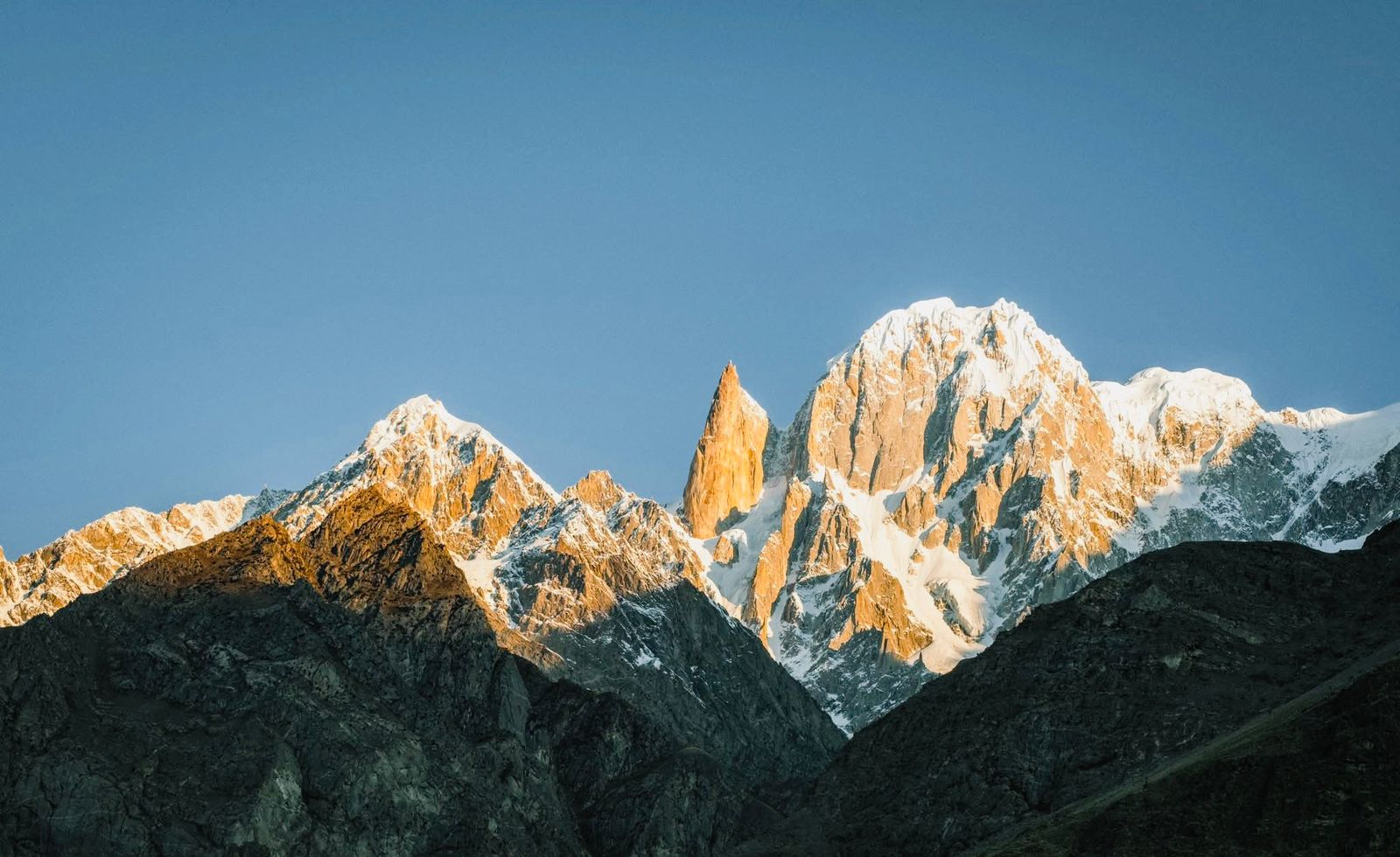
Slowly return to enjoy this spectacle until the motorable track where we join the Karakoram Highway in 4×4 and … our luggage! From there, transfer to Karimabad. The Hunza territory is a wide mountain valley which extends along the eponymous river, overlooked by high peaks which make its reputation: Rakaposhi (7788 m), Diran Peak (7266 m), Spantik (7027 m), Ultar (7388 m), Lady Finger Peak (6000 m) … The warm welcome of its inhabitants is as good as the landscapes. Dinner at the hotel.
Elevation gain: 1000 m. 3 hours of walking and 3 hours of driving.
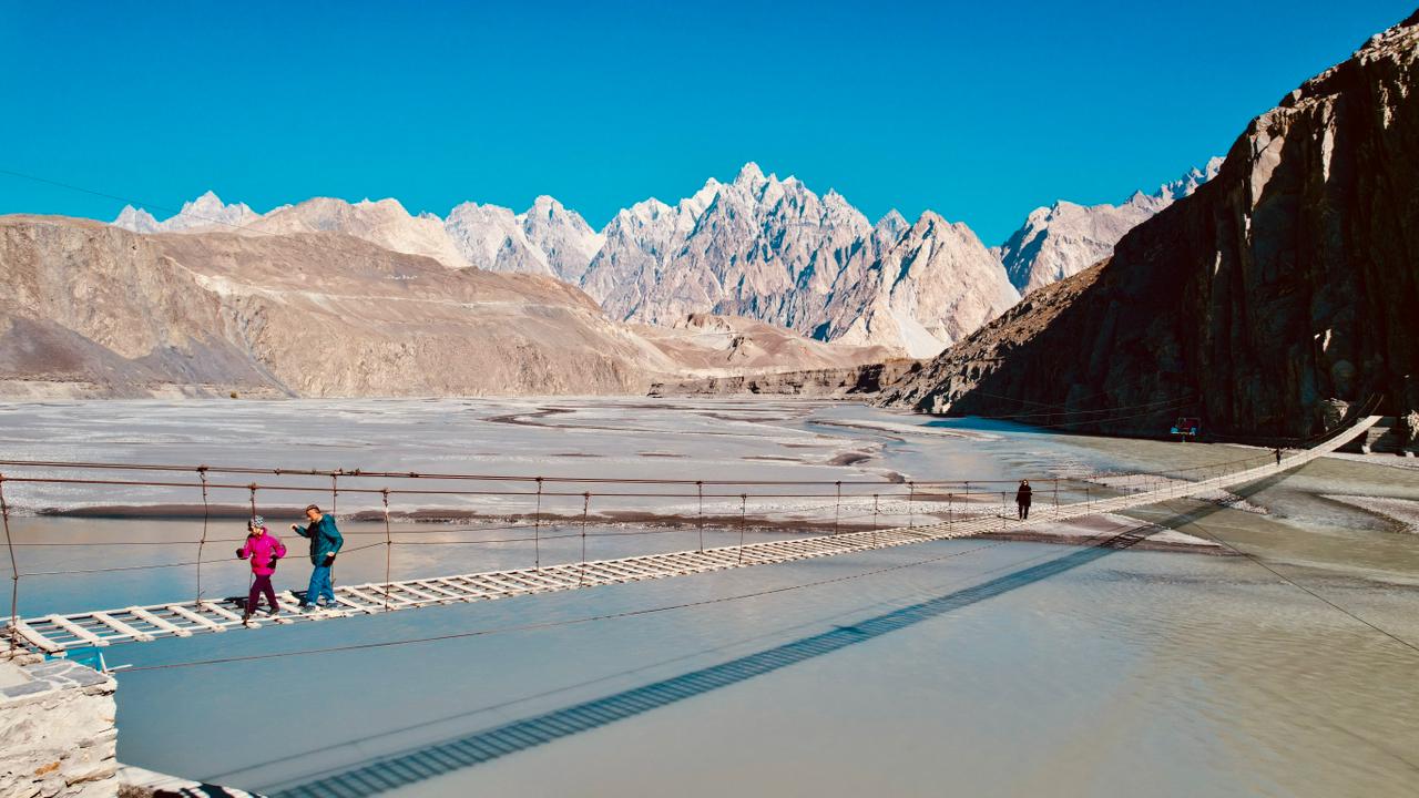
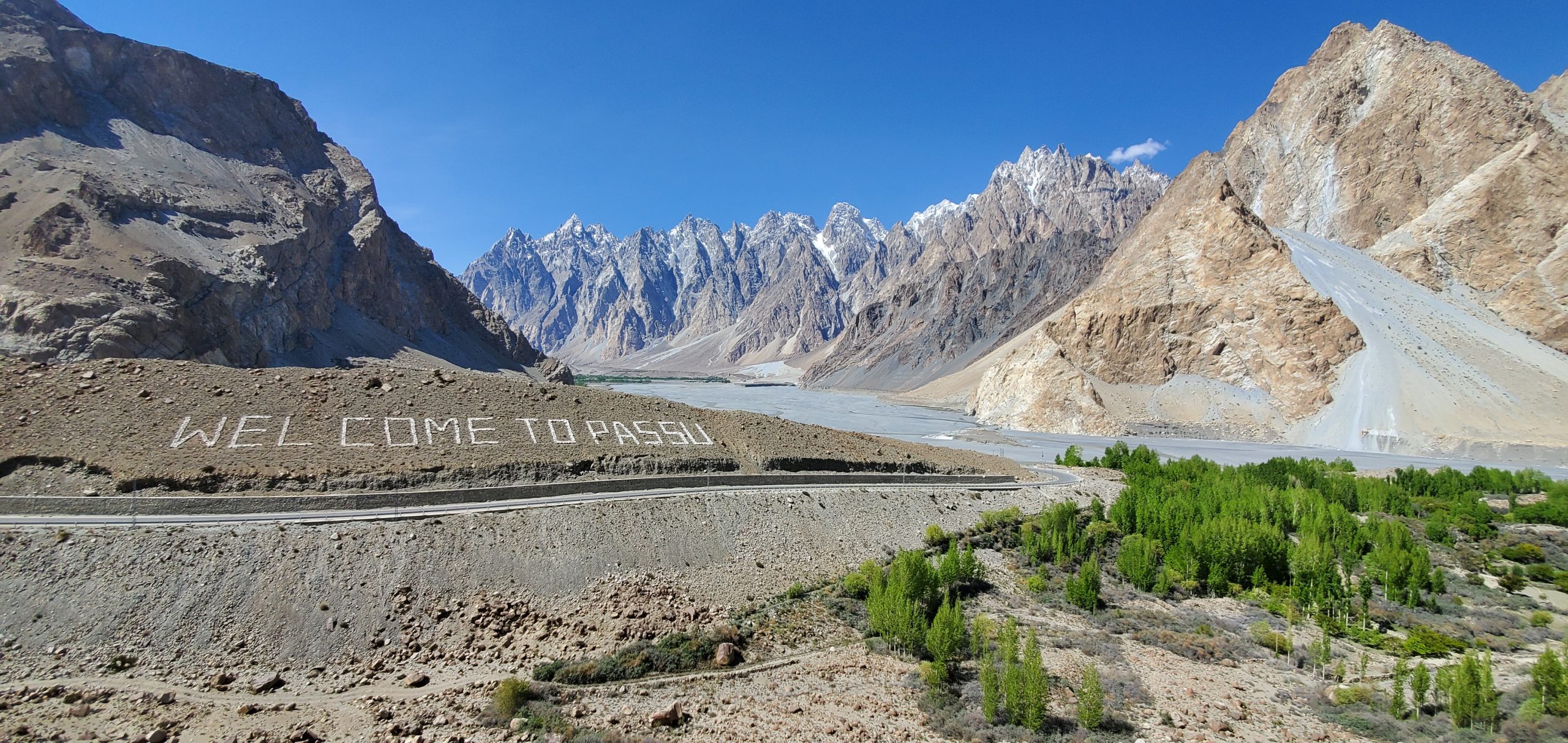
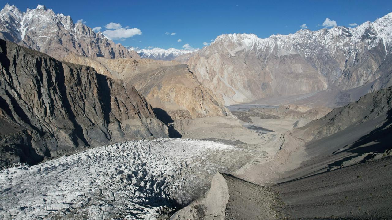
Visit the Altit Fort, a UNESCO World Heritage Site, before departing Karimabad by vehicle to travel up the Hunza Valley along the famous KKH (Karakoram Highway). We pass through picturesque villages nestled in oases dominated by high glacial mountains. We explore Lake Attabad, with its magnificent turquoise waters winding through the valley for over 20 kilometers. We stop at the Gulmit suspension bridge, once the second capital of the Hunza Valley. A short detour takes us to Lake Borith, then a 2-hour round trip climb to a lookout point where we can observe the Passu Glacier. We finally arrive at the village of Passu to spend the night at the hotel. Spectacular sunset over the “Cones of Passu” Dinner at the hotel.
2-hour walk.
Accommodation: hotel. Meals included: breakfast, lunch, and dinner. Transfer: 4 hours of trail riding. By Jeep, we leave the Karakorum Highway to head into the Shimshal River Gorge via a rather spectacular track that has only been accessible since 2003. Before that date, the Shimshal Valley was completely isolated and it took four days of walking to reach the village. Today, in just a few hours, we reach this magical place where man has adapted in harmony with nature, which is very demanding in this place. The afternoon will be spent wandering along the irrigation canals, gaining some altitude and discovering the terraced crops, meeting the locals… Overnight at the hotel where we can leave some belongings before setting off on our trek.
2-hour walk.
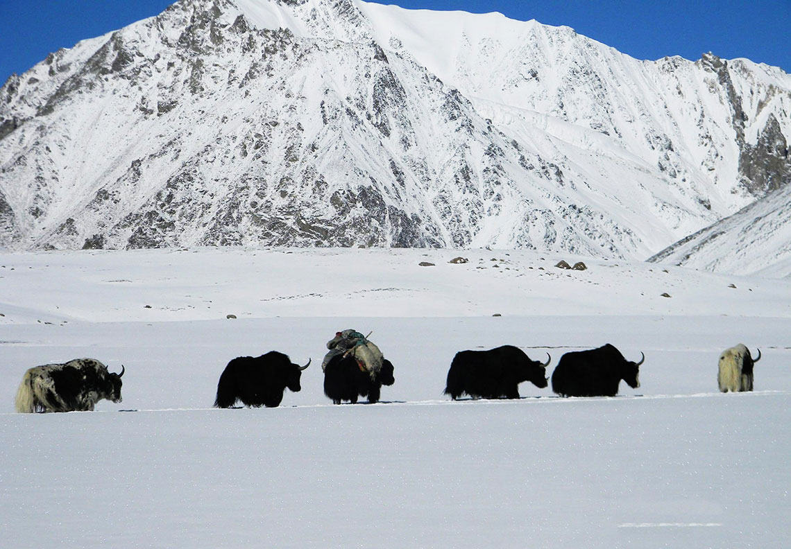
We could have stayed a week in Shimshal, but the heights are calling us! Every year, a few shepherds leave the village from May to October to take the yaks, goats, and sheep to graze the high pastures of Shuwerth. Up there, they guard the herds and take care of breeding. It will take us three days of climbing to reach this little mountain paradise, so we leave early and begin our trek along the Shimshal River, which we will have many opportunities to cross during the day. We reach Gar Sar in the afternoon in a mineral atmosphere.
Elevation gain: 550 m. Elevation loss: 250 m. 4 to 5 hours of walking.
We set off early for our second day of trekking. The day promises to be extraordinary, starting with a spectacular ledge trail before arriving at Wusthfusin. We then cross a suspension bridge called Chichan Bridge. Another 2 hours of climbing to reach the Peryen Sar lookout, which offers the best view of the Maidur Valley, Chashkin Peaks (6,000 m), and Mangligh Sar (6,050 m). A real movie… Overnight in camp.
Elevation gain: 1050 m. Elevation loss: 750 m. 7 to 8 hours of walking.
After 1 hour 30 minutes of gentle balcony trail, on the right bank of the Pamir Tang, we reach Arbob Paryen before entering the Shujerab Valley, the “black valley”. The river flows through the middle, the shepherds’ shelters are scattered and the yaks graze peacefully. It is in the middle of this peaceful setting that we camp. The coveted paradise is not far away.
Elevation gain: 780 m. Elevation loss: 420 m. 5 to 6 hours of walking.
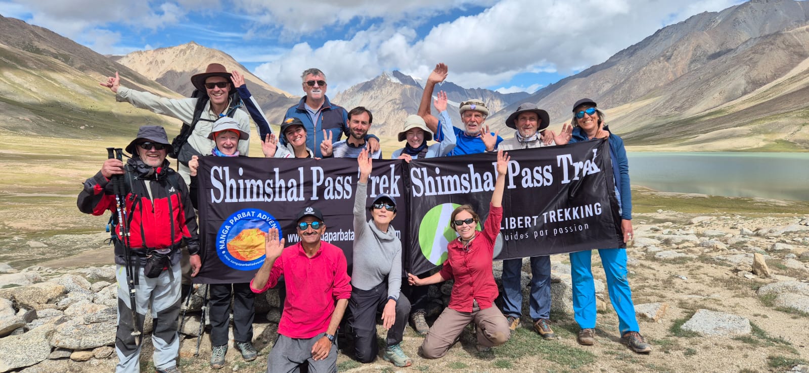
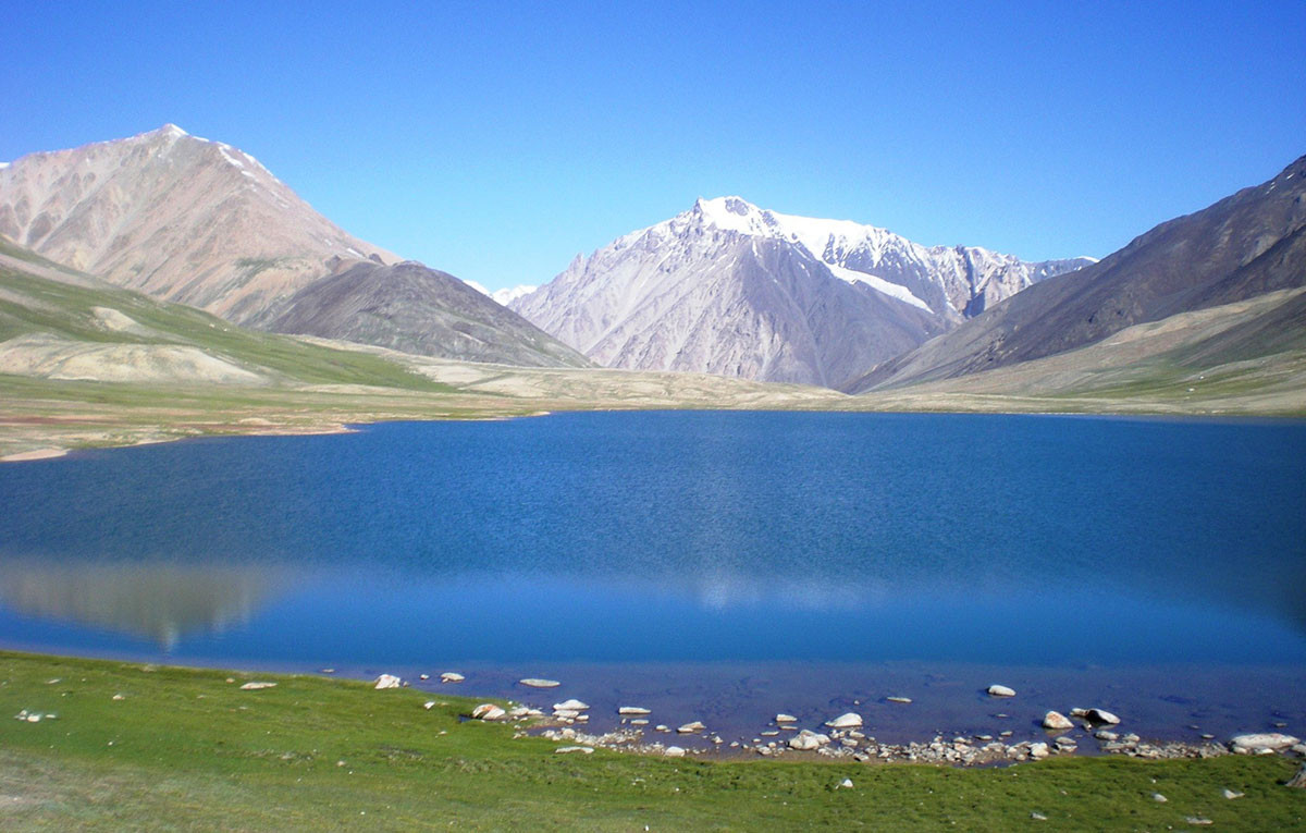
We quickly reach the pre-pass of Shimshal Pass at 4,630 meters (a sign indicates the Shimshal Pass, but the real pass is further, after the lakes..). Eric Shipton, a great mountaineer and explorer of the 1930s, traveled these valleys to draw up the first maps of the region. Arriving at Shimshal Pass, he sat for a long time on the ridge to admire the beauty of the place: below the pass, a beautiful blue lake, behind, a wide plain where hundreds of yaks, goats and sheep graze and, on the sides, a succession of snow-capped peaks including Mingli Sar at 6,050 meters. We descend to Joy, an old shepherds’ “village” on the edge of the lake. The rest of the day will be spent exploring the place and enjoying this world with its end-of-the-world feel.
Elevation gain: 400 m. 4 to 5 hours of walking.
Free day with the possibility of numerous acclimatization walks (we can climb to 5000 m for those who wish), contemplation, etc. We are at the foot of Mingli Sar (6050 m), a summit that some of us will try to reach the next day.
Note: This day can be used to set up a high-altitude camp on the rocky ridge to reduce the effort the next day for those climbing Mingli Sar (see our “Additional Services” section). The decision will be made by the guide
Departing very early in the night, we climb an easy rocky ridge before roping up and donning crampons to gain a foothold on the glacier. Depending on the conditions, the slope (45 to 50°) can be snow or ice. We skirt the left side of the large crevasse that scratches the face before reaching the summit. A spectacular view rewards us for our efforts. Descent by the same route.
Note: For those who are not climbing Mingli Sar, there are tailor-made walks, relaxation, contemplation, etc. Our local team will be there to meet all your expectations.
Elevation gain: 1300 m. Elevation loss: 1300 m. 8 to 12 hours of walking
We retrace our steps after this interlude out of time.
Elevation gain: 200 m. Elevation loss: 1000 m. 6 to 7 hours of walking.
We leave the valley and plunge into a rarely used perpendicular valley, where the path becomes steeper. We set up camp at Maidur, another grazing camp.
Elevation gain: 500 m. Elevation loss: 100 m. 5 to 6 hours of walking.
We leave our camp for a long and superb day of walking. The climb is slow and gradual at first before steepening below the rarely used Shpoadeen Pass. From there, the views are worthy of our efforts with a multitude of peaks: Disteghil Sar (7885 m), Yazghil (7324 m), Momhil Sar (7343 m), Lupgar Sar (7200 m) and Mulungutti Sar (7025 m). The descent is steep and we have to watch where we put our feet before we return to the mountain pastures where we set up our camp.
Elevation gain: 1000 m. Elevation loss: 800 m. 7 to 8 hours of walking.
We return to the Shimshal mountain pastures after this timeless trek.
Elevation gain: 1350 m. 6 to 7 hours of walking.
Breakfast in Shimshal and a final moment in this remote valley, yet with such a warm welcome. Drive to Gilgit via the Karakorum Trail and Highway.
Early in the morning, transfer to Skardu airport and flight to Islamabad, flying over the Nanga Parbat massif again. Check-in at the hotel and free time.
1 hour flight and 3 hours on the runway.
Drive to Taxila. Listed as a UNESCO World Heritage Site, this archaeological site, one of the most important in Asia, is actually a collection of remains of Buddhist dwellings and monasteries scattered within a radius of about thirty kilometers. It reached its peak between the 1st and 5th centuries AD. Visit the sites of Jaulian, Mohra Moradu and Sirkap, then return to Islamabad.
Transfer to the airport for return flight.
Please Note:
Peak Season: Late June to early September. This is when the snow has mostly melted from the passes, and the trails are clear.
The trek is rated as Challenging to Strenuous.
Terrain: You will navigate steep ascents, rocky scree slopes, and narrow paths above deep gorges
Altitude: The Shimshal Pass sits at 4,735m (15,535 ft). Proper acclimatization is mandatory to avoid Altitude Mountain Sickness
Physical Fitness: You should be in excellent cardiovascular shape and comfortable walking 6–8 hours a day on uneven ground.
Permits: For foreign trekkers, Shimshal is generally considered an “Open Zone,” meaning a formal trekking permit from the Ministry of Tourism isn’t always required for the standard pass trek.
Guides: it is strongly recommended to hire a local Shimshali guide. The trail involves tricky river crossings and sections where the path can be obscured by landslides
Yes! The most popular “trekking peak” in the area is Minglik Sar (6,050m).
Footwear: Sturdy, broken-in trekking boots and a pair of sandals/crocs for river crossings and camp.
Sleeping Gear: A 4-season sleeping bag rated to at least -15°C (5°F), as nights at the pass are cold even in summer.
Clothing: Layers are key. Include a down jacket, waterproof shell, and moisture-wicking base layers.
Sun Protection: The UV radiation at 4,000m+ is intense. Bring high-SPF sunscreen, polarized sunglasses, and a wide-brimmed hat.
The K2 Gondogoro La trek is a popular adventure, this trek takes you through some of the most stunning scenery in the Karakoram Mountains, including K2 Base Camp, Gondogoro La Pass, and the Baltoro Glacier.
This unique and exciting trip will take you to one of the most scenic plateaus of Deosai at 3980 meters. Although this plateau is quite well visited by the foreigners and locals, but their visits are generally limited to roadside stops.
Around Nanga Parbat Trek is a challenging but rewarding adventure that takes you on a circular route around the majestic Nanga Parbat, the ninth-highest mountain in the world. This trek offers stunning views of the mountain’s various faces, including the iconic Rupal Face, as well as other impressive peaks in the surrounding region.