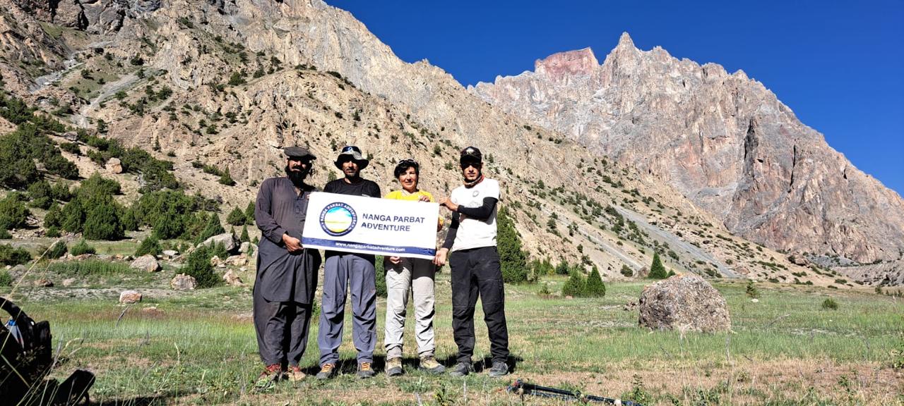
Rakaposhi Base Camp & Patundas
This spectacular trekking program is an ideal combination of adventure and culture, giving you an opportunity to observe the life style of various tribes residing under the shadow of snow covered mountains.
The Batura Werthum Pass and Fairy Meadows trek is a breathtaking journey deep into the heart of Pakistan’s northern mountains, combining one of the Hunza Valley’s most remote high-altitude routes with one of Gilgit-Baltistan’s most iconic alpine meadows. Beginning along the snout of the vast Batura Glacier, one of the longest glaciers outside the polar regions, trekkers follow rugged moraine, turquoise glacial streams, and untouched highland pastures as they ascend toward the Werthum Pass a dramatic vantage point that reveals sweeping panoramas of the Batura Wall and surrounding peaks.
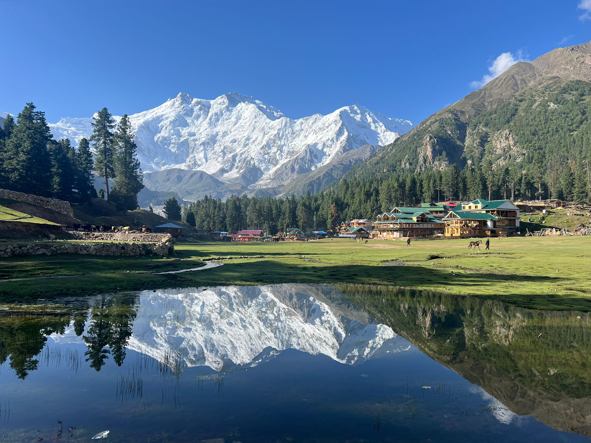
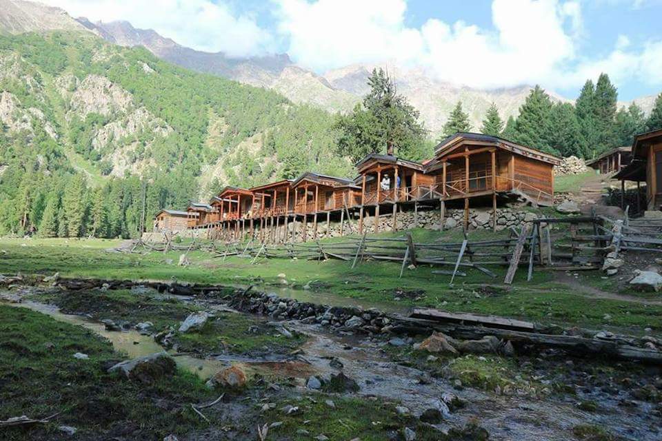
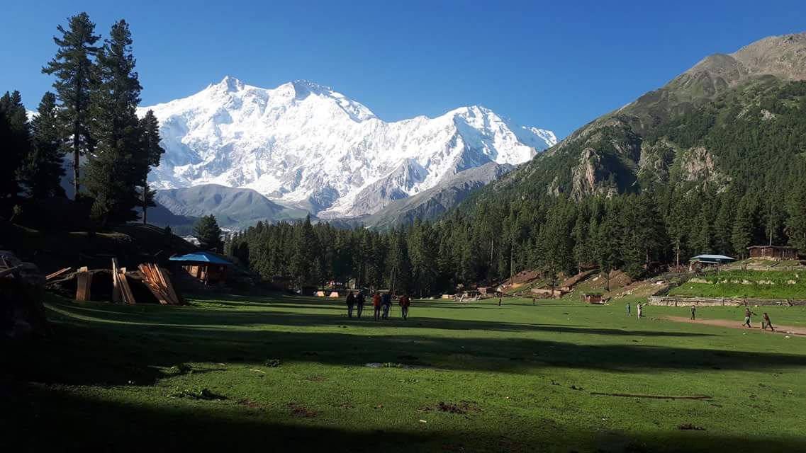
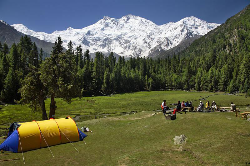
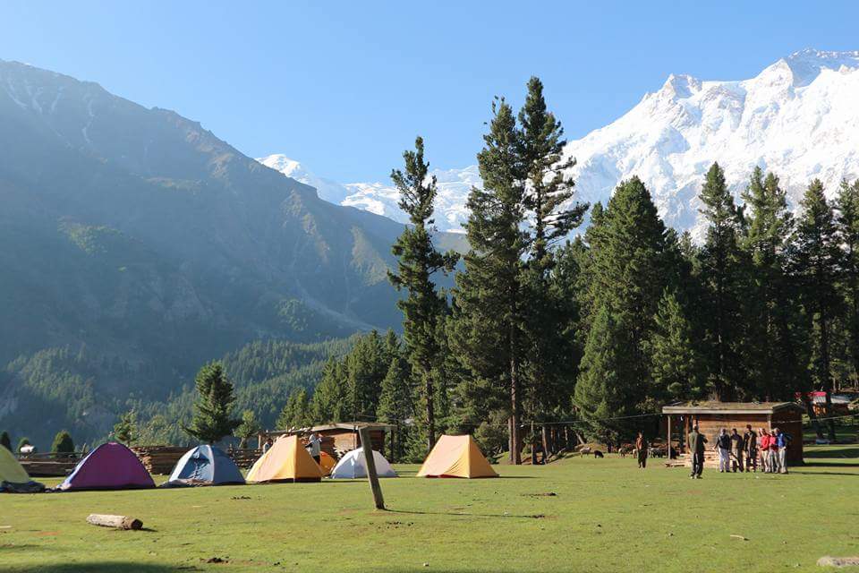
From this wild, isolated landscape, the adventure transitions into the lush serenity of Fairy Meadows, a place famous for its emerald meadows, wooden cottages, and unforgettable views of Nanga Parbat, the “Killer Mountain.” Here, the stark contrast between the harsh glacial world and the soft alpine beauty creates a uniquely diverse trekking experience.
Combining challenging terrain, rich cultural encounters with local Wakhi communities, and some of the most spectacular mountain scenery in the world, the Batura Werthum Pass and Fairy Meadows trek stands as a rewarding expedition for those seeking both adventure and tranquility in Pakistan’s remote north.
Welcome at Islamabad airport, and transfer to hotel, after refreshment proceed for city tour of Islamabad and Rawalpindi, which includes famous Faisal Mosque, Shakar Parian, Pakistan monument, Damen Koh, Lok Versa, Museum, Rawalpindi old bazaar, Raja Bazaar. Overnight at Hotel.
Fly to Gilgit 1 hrs flight over the Nanga Parbat 8125m a dream flight. After landing in Gilgit, we will drive to Karimabad, 3 hrs. drive. Overnight at hotel .
Full day in Hunza, where we will be visiting Baltit Fort 700-Year-old. Baltit fort: One of the high valleys between China and Indian subcontinent. Facing Rakaposhi Peak, one of the highest mountain peaks in the world, Baltit Fort is poised majestically above Karimabad, the present-day capital of Hunza (Baltit was the capital of the old state of Hunza and is now included in the Karimabad settlement area). Overnight hotel .
Morning drive to passing through the scenic villages and snow covered peaks towering above. We will visit the Atta Abad Lake and then hanging bridge in Gulmit and visit Borit Lake. Overnight in hotel.
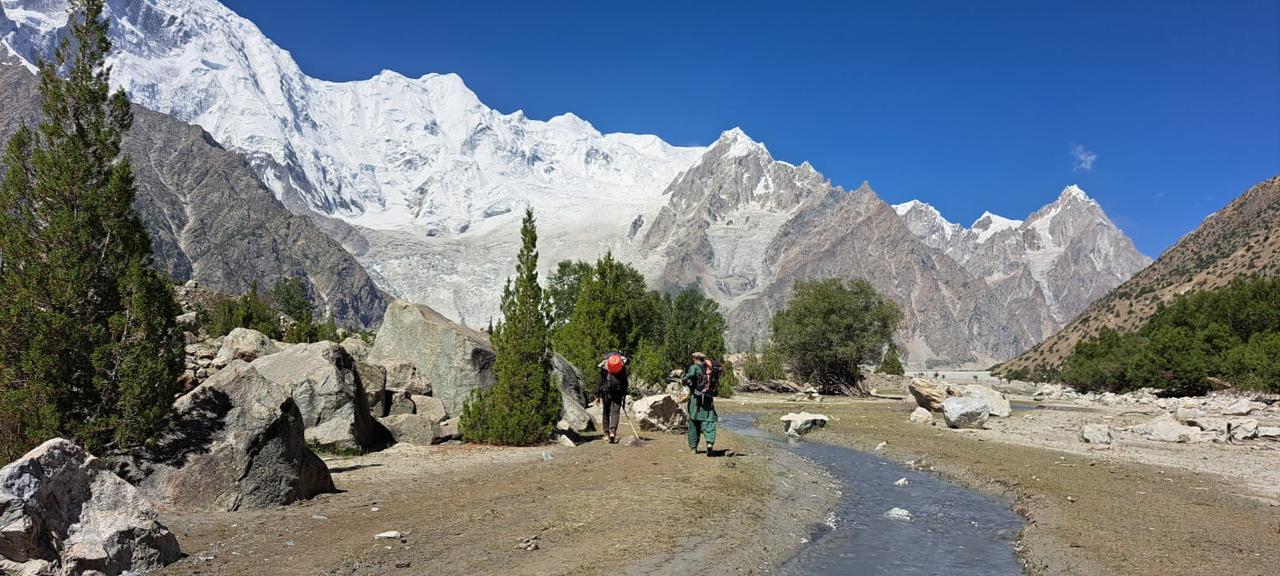
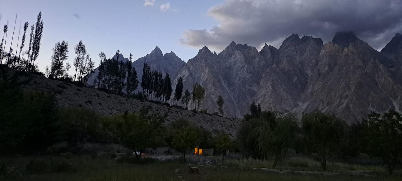
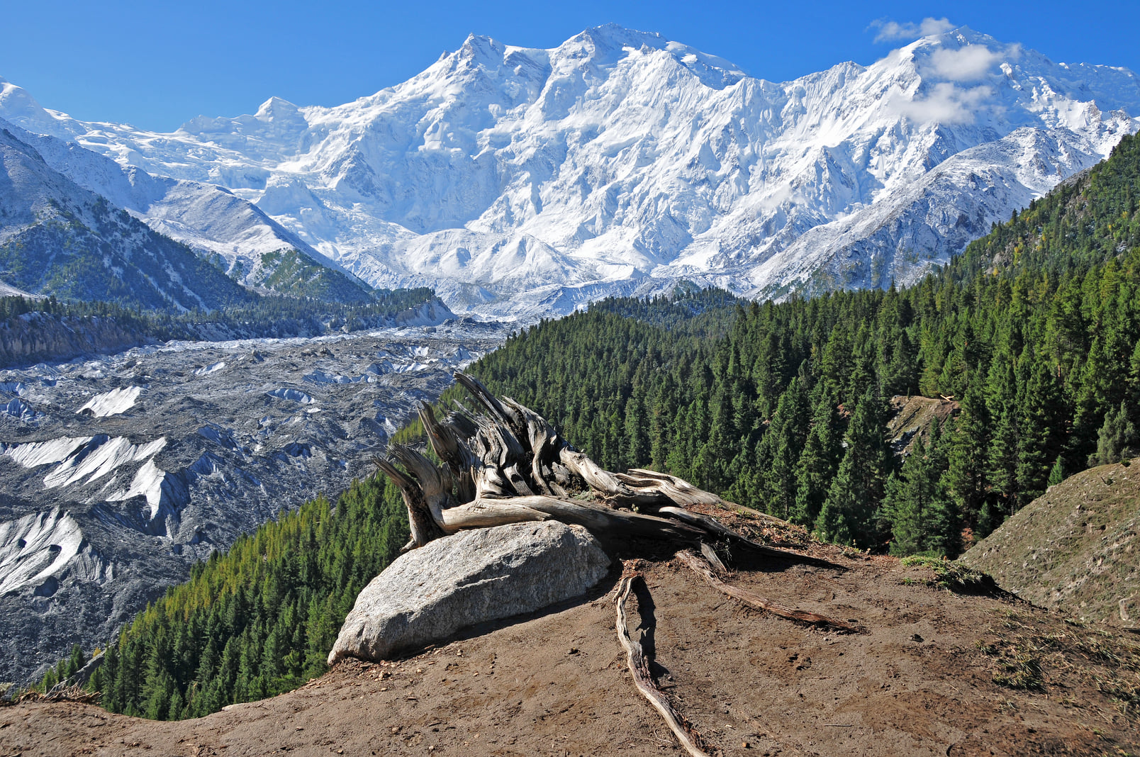
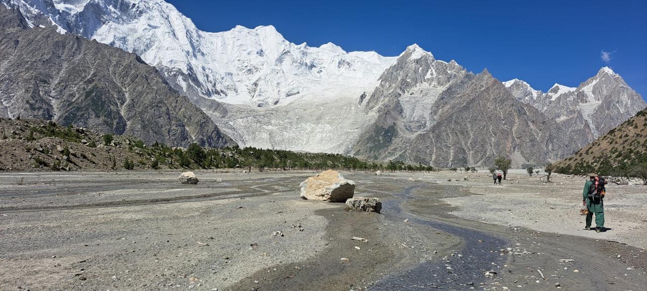
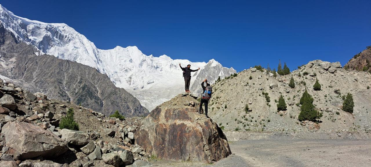
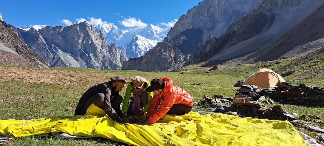
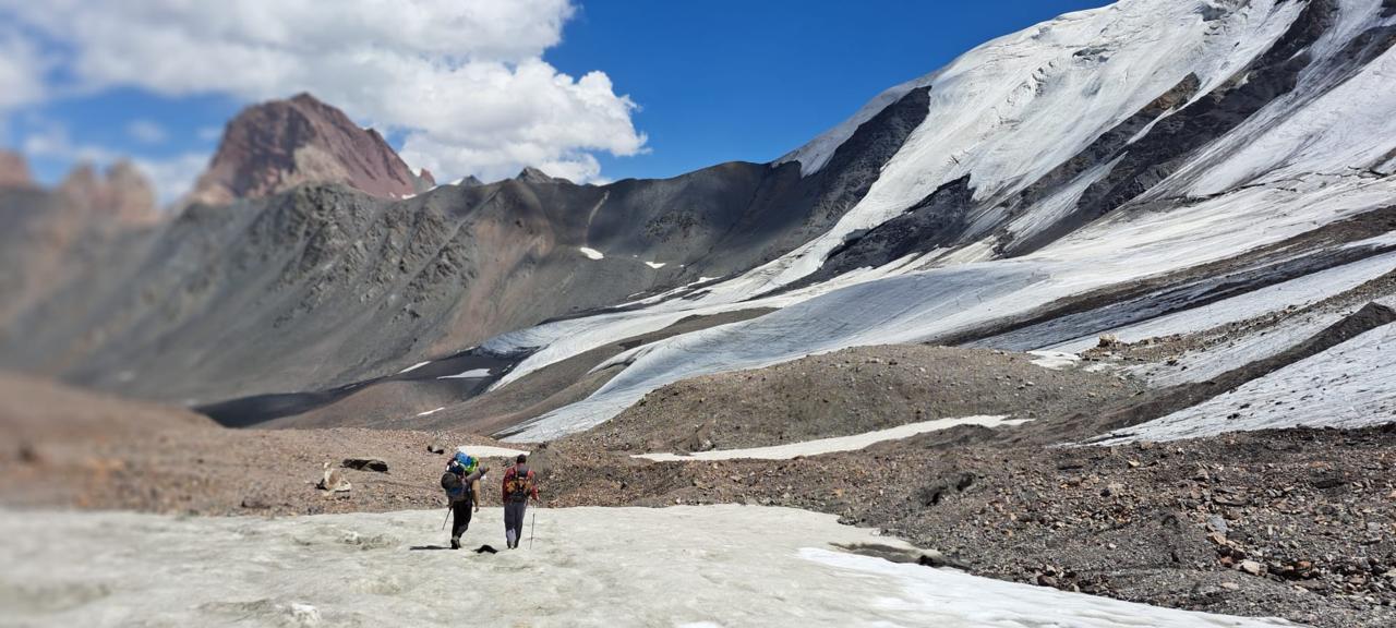
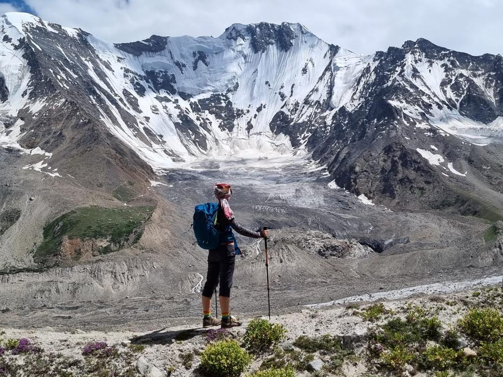
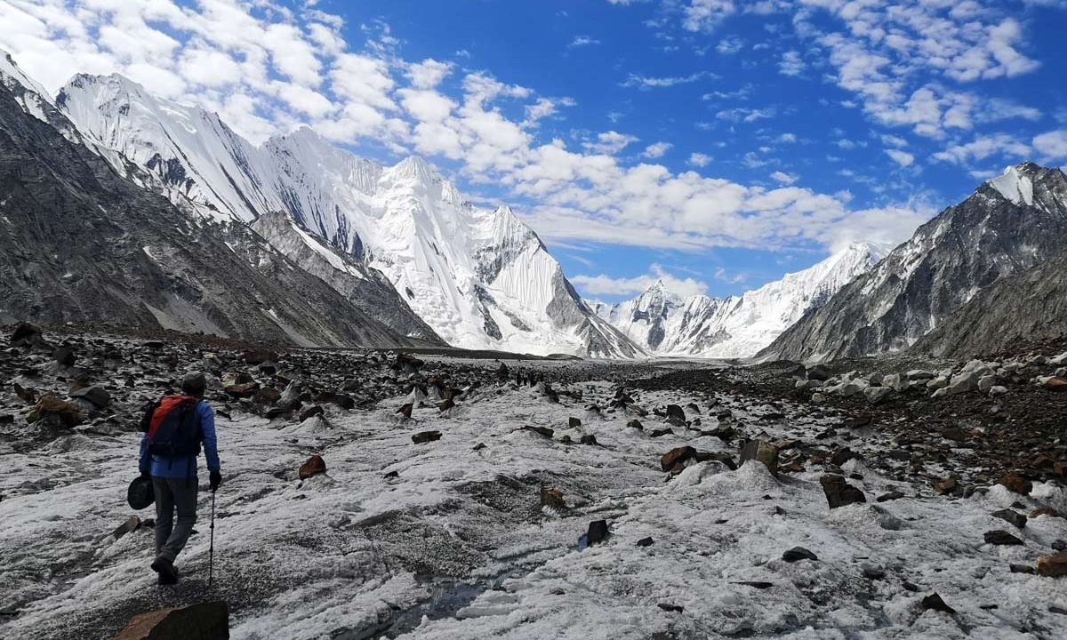
Trek to Yunzben (2880m): 11.5km, 6-7 hrs, it takes about 6 to 7 hours walking on dusty trails at the snout of the huge Batura Glacier. The Batura is even longer than the famous Baltoro Glacier in the K2 region overnight in tents.
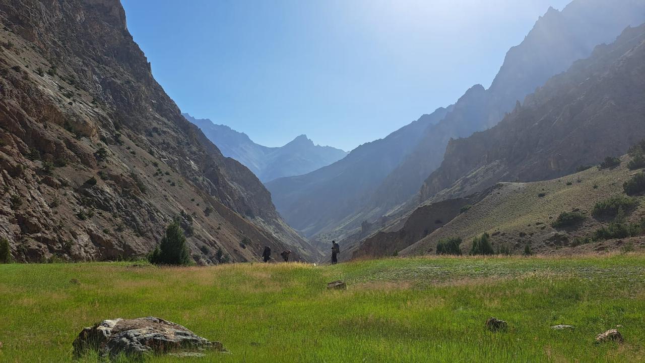
Trek to Yashpirt 6-7 hrs, 5.7km, 3302m .Today we diagonally cross the Batura Glacier. This is a tiresome day with lot of walking on rocks and the moraines of Batura. Yashpirt is a beautiful high meadow with many shepherd huts and fantastic views of the Batura peaks and the famous Batura ice fall across the glacier from us. We can also see DistaghilSar (7,885 m.) from here. DistaghilSar is the highest most western mountain in Trans-Himalayan and one has to go around the globe to come back to the eastern Himalaya to find such high peaks. Today’s walk takes about 6 to 8 hours. Overnight in tents
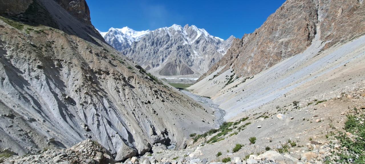
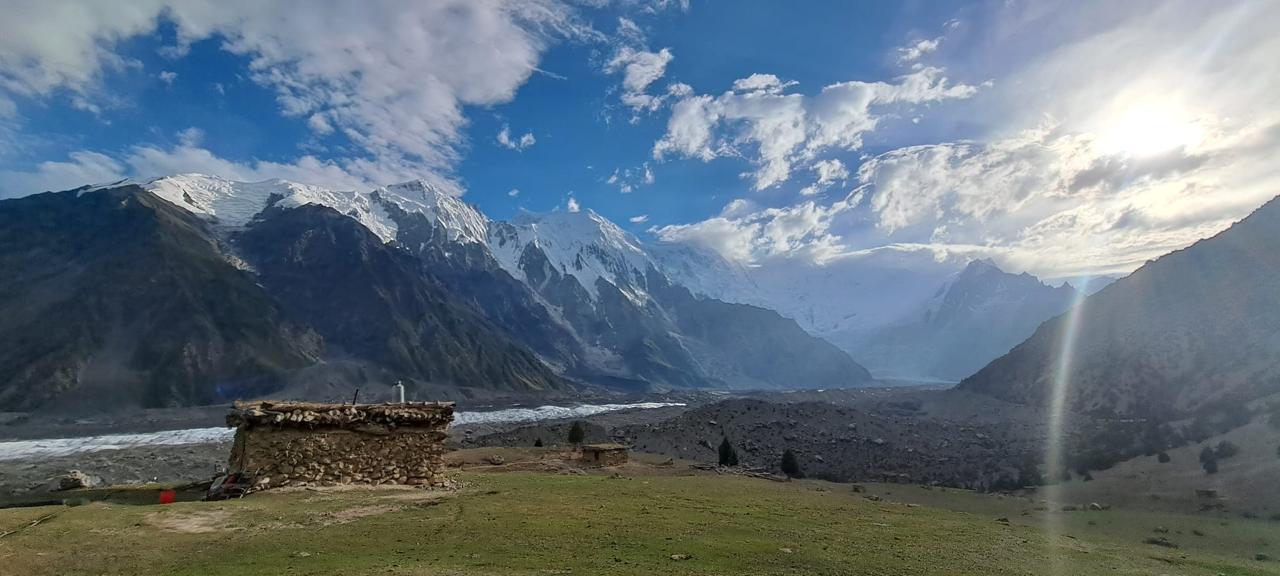
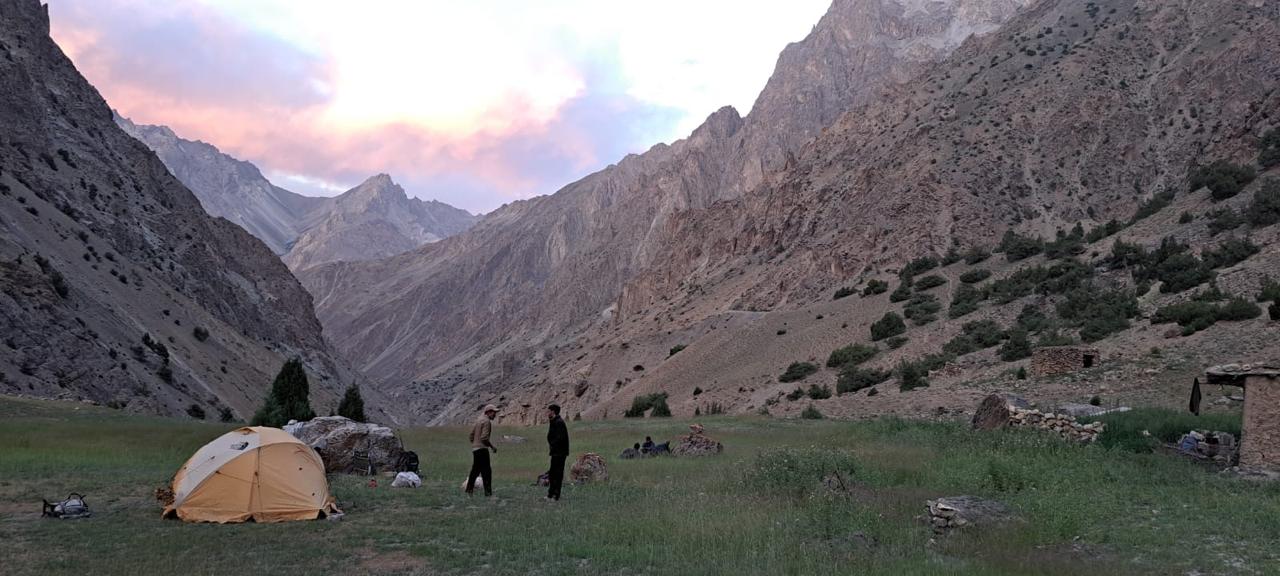
Trek to Shireen Maidan 6-7 hrs, 16.9km, 586m ascent, 3888m, Descend west past large junipers to the alluvial plain in the ablation valley. Follow the easy trail north-west, through a lovely series of small ablation valleys, amid abundant junipers, willows and birches. An hour from Yashpirt, pass an old distinctive millstone, which was used until the late 1970s when barley was cultivated at Yashpirt and the primary summer pasture was Fatima,il Sheet. Occasional willows line the trail along a meandering stream. In 15 minutes, reach Piyakh Sheet (3345m) where a strange stand of turugokh, a kind of poplar, grows. The terrain opens onto a broad alluvial fan called Fatimhail Sheet (3402m. a side stream, Fatimahil stream, flows across the fan as the trail continues north-west end, nestled against an Eolian fluted cliff, 30 minutes from Piyakh Sheet. Continue up the ablation valley, passing through a wooden doorway, and reach the confluence of the good-sized Werthum Nala and the Batura Glacier 30 minutes from the Fatima,il huts. Werthum Nala, the stream draining the Werthum valley, parallels the Batura Glacier for 7.5km before disappearing dramatically under the Batura glacier here. Ford the stream just above the confluence and continue along its true right (south) bank one hour to Kukhil (spring side sheep pen) where a wooden footbridge leads to the hillside huts and livestock pens. From Kukhil, go along the true right (south) bank 1 ½ to two hours to another large alluvial fan called Shilmin (3627m)
From Shilmin the trail up the Werthum valley leaves the Batura Glaciers’ north margin bending 90 degrees and follows the Werthum Nala, s true right (west) bank north-east. Massive scree slopes on both the valley’s east and west walls guard its entrance. Stay close to the hillside (on both the valley’s east and west walls guard its entrance. Stay close to the hillside. Shireen Maidan (3888m) is a preferable campsite to Shilmin, well worth the additional 1 ½ hours walk. The peaks above the glacier offer climbing possibilities. overnight in tents.
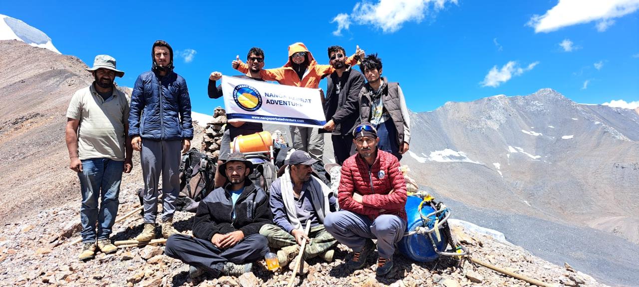
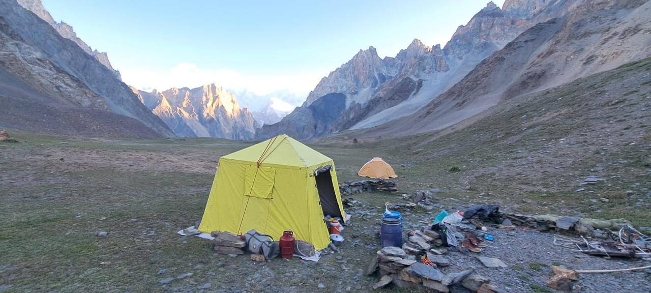
Trek to Werthum base camp 3-4 hrs, 3.8km, 4975m ascent, 4363m .Recross the river to the Werthum Nala, s true right (west) bank and immediately ascend the steep scree slope on a yak trail to the grassy slopes above. Traversing high above the river gorge, the trail a crosses three small ravines, the last two of which offer clear water. Before the second stream, 1 ½ hours from Shireen Maidan, a difficult section of trail rounds a yellowish rock face called Dzug Band (literally, difficult yak trail in Wakhi) a few minutes farther ahead, a house-sized overhanging boulder offer shelter and marks the beginning of the huge area known as Werthum, which extends all the way to the valley’s head. Fifteen minutes past the third stream the going gets a little easier, and cauliflower like edible plant and purple flower, whose dried petals can be used to make a tea that assists with acclimatization, pop up between the shale, ephedra, and patches of grass. A lone stone circle, which is used as porters, shelter, marks Werthum Base camp (4363m in the middle of an exposed, broad grassy plateau above the confluence of the two unnamed streams that join to from Werthum Nala. The stream from the north-west issues from the glacier lying at the base of Werthum Peak, whose summit dominates the valley head. The other is the outwash stream from the sizable unnamed glacier that descends from several 5000m peaks east of Werthum base camp. Overnight in tents.
Trek to Werthum High camp 3-4 hrs, 3.4km, 612m ascent, 4975m, Follow a faint yak trail for 1 ½ hour, staying very high above the true left bank of the Werthum Nala,s north-west branch. The route traverses north-north-east over stable slate and talus heading towards the rounded peak (5426m on the Swiss map) whose dry slopes are capped by snow. Werthum Pass lies on the ridge that runs south-east between this peak and peak 5315m. The route to the pass is via the side valley immediately in front of peak 5426m. The reliable clear water flows in the second side stream before the highest grassy patch where yaks sometimes graze. Cross a dry gully 30 minutes beyond the grass, then head north another 30 minutes beyond the grass, then head north another 30 minutes up a relentlessly steep rock- and scree-covered hillside. The angle steepens to 25 degrees towards the ridge top. Traverse scree 45 minutes to one hour to Werthum high camp 4975m on a level rocky terrace high above the true left bank of the stream descending from the pass. Overnight in tents
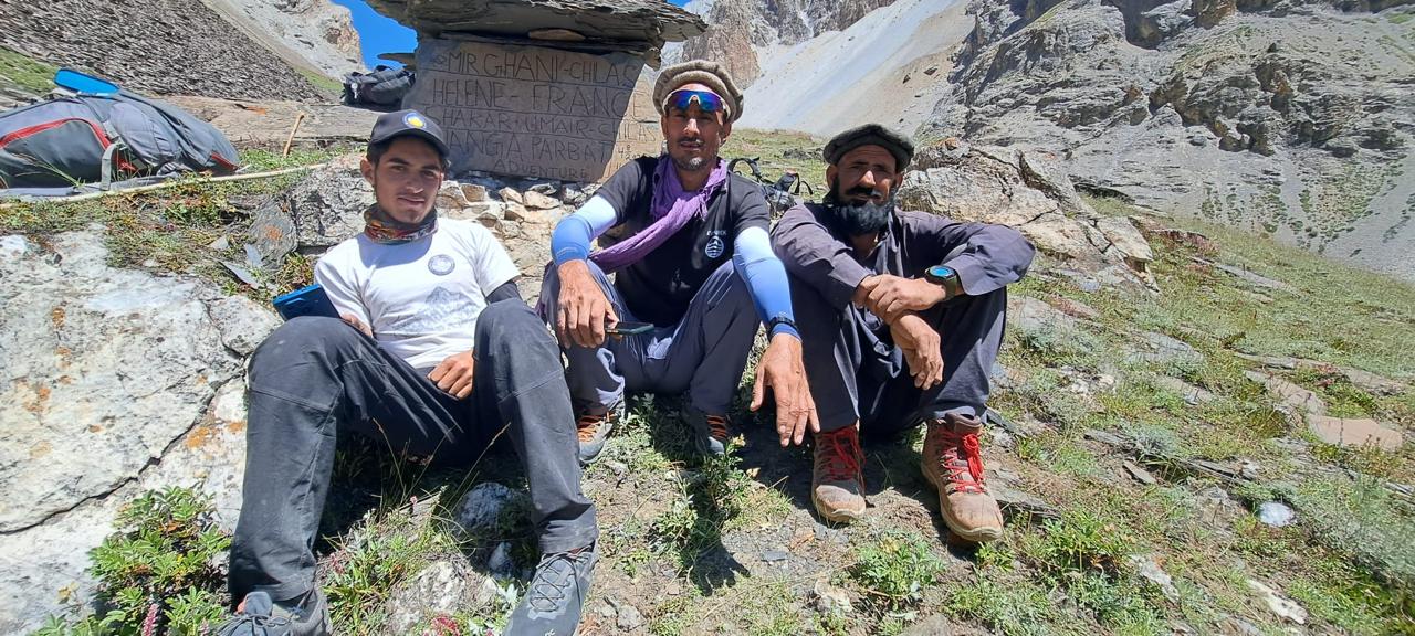
Trek to Harkeesh after crossing Werthum Pass (5147m) 6-7 hrs, 6.1, km, 172m ascent, 1658m descent. Continue up the snow and scree slope to reach Werthum Pass 5147m, 45 minutes from the high camp. The pass has 20-to-25 degree slopes on both sides and a permanent 3m to 4m vertical cornice on its north side. Use a rope belay while breaking through the cornice and cutting steps in the ice to reach the talus below the pass. The pass is more difficult before mid-July when there are more snow and a larger cornice.
Descend the talus and scree slope, and then cross a tiny bergschrund onto a small unnamed glacier. Cross the glacier in 15 minutes to moraine and a stream. Cross to its true left bank, and follow the stream down 30 minutes to a level area (4694m). Eventually, you reach the highest pastures along the stream true right bank and pick up a faint, but obvious, livestock trail. The going becomes easier, and in 15 minutes the trail descends to cross a convenient boulder to the stream true left bank. Pungent juniper dot the slope. From a ridge five minutes beyond the natural bridge, Harkeesh (place of cultivation in Burushaski) a level grassy area, is viable below. Descend the steep slope on a poor trail past junipers wild roses and abundant birches 30 minutes to a log footbridge. Pause to marvel at the colorful sculpted rock cleft from which the stream emerges. Follow the path along a canal 15 minutes to Harkeesh (3489m). Water from the canal flows to Harkeesh in the afternoon. Overnight in tents.
Trek down to Raminj 3-4 hrs, 394m descent, 3095m, Trek through beautiful ancient Juniper forest, cross the footbridge over a muddy stream. Harkieesh is the valley only Burushaski place name. Named by Burusho from Raminji who tried to farm here. From Harkeesh descend steeply 10 minutes and cross a side stream via a footbridge. Birches, roses, tamarisks, and junipers flourish in this area. Five minutes further cross a sturdy footbridge to the Lupgar River true left bank. The trail from here to Raminj is considerably better, although it’s still exposed in place. For the next 1 ¼ to 1 ½ hour to the Raminji canals head works, the trail traverses high above the river gorge occasionally dropping closer to the river. Midway passes a footbridge to the lupgar river true right bank above the confluence of the Lupgar and Dior rivers leading to the Dior Hut. Follow the path along the willow-lined canal one hour to Raminj, passing several gushing springs en route. The canal begun during the reign of Mir Muhammad Jamal Khan and completed in 1978, is a marvel of construction, several tunnels, built through the cliff, carry the canal under scree slopes that the trail crosses. Raminj (3095m) which lies above the confluence of the Lupgar and Chapursan rivers, it a beautiful well-tended east and south facing village. overnight in tents
Drive to Passu by Jeeps and continue 4hrs drive to Gilgit. Overnight hotel
Early in the morning, drive to Raikot bridge , from where we will drive with local 4×4 Jeeps to Tato, after the end of the jeep road we will start our trek to Fairy Meadows. From Raikot bridge to Tato we need be 1 hrs 30 minutes, drive on 4×4 Jeep, from there we will Walk on green hilly and forest paths around 2 to 3 hrs to reach Fairy meadows the most beautiful and long wall of 9th highest mountain in the world. Nanga Parbat (8125 meters). Overnight at wooden huts.
4 – hrs drive and 3 hrs walk.
Optional day to hike up the Nanga Parbat Base camp and visit the memorial of the climbers in Base camp. An Easy walk crossing the summer houses of local people. We will have our lunch on way back from Base camp in Bayle. Overnight in Fairy Meadows. Overnight wooden huts.
Approximately 6-7 hrs walk.
Morning we will trek back to Tato and transfer on 4×4 jeeps to KKH where our buses will wait for use to continue our journey towards Gilgit. In Gilgit we will visit the 7th century AD Buddha Rock Carvings at Kargha afterwards we will walk through the mountains bazars of Gilgit .Overnight at hotel.
4 – hrs drive and 3 hrs walk.
After breakfast Drive to airport for domestic flight .our flight to Islamabad 1 hrs flight over the Nanga Parbat 8125m a dream flight. After landing in Islamabad we will be vising Taxila. Taxila: Most of the archaeological sites of Taxila which dated from (600 BC to 500 AD) are located around Taxila museum. For over one Thousand-year Taxila remained famous as a center of learning Gandhara art of sculpture, architecture, education, and Buddhism in the days of Buddhist glory. There are over 50 archaeological sites scattered in a radius of 30 km around Taxila. In Taxila visit archaeological sites of Jaulian, Mohra Moradu, and Sirkap. It is one of the best and well-maintained site museums of Pakistan. Overnight at Islamabad Hotel or Envoy continental.
If in case our flight cancel due to bad weather we will stay in Gilgit and wait for next day flight .In Gilgit we will be visiting the Kargah Buddha. Kargah Buddha is an archaeological site located about 6 miles outside of Gilgit, Gilgit-Baltistan, Pakistan. It is a carved image of a large standing Buddha in the cliff-face in Karghah Nala. The carving, which is in a style also found in Baltistan, probably dates to the 7th century. Overnight at hotel
Fly to Islamabad 1 hrs flight over the Nanga Parbat 8125m a dream flight and Transfer to hotel. Or After a long and hard trekking and journeys we will take a long sleep. After breakfast we will be ready for sightseen of Islamabad, visiting the Log Virsa Museum where you can experience all four province culture, way of life and the strong cultural interaction with neighboring countries of Pakistan, later we will give time to walk around the bazars. In the evening will have all together farewell dinner from Nanga Parbat adventure at Monal restaurant on the Margala hills .Overnight at hotel
Transfer to Islamabad airport for international flight
Please Note:
This spectacular trekking program is an ideal combination of adventure and culture, giving you an opportunity to observe the life style of various tribes residing under the shadow of snow covered mountains.
Around Nanga Parbat Trek is a challenging but rewarding adventure that takes you on a circular route around the majestic Nanga Parbat, the ninth-highest mountain in the world. This trek offers stunning views of the mountain’s various faces, including the iconic Rupal Face, as well as other impressive peaks in the surrounding region.
One of the most adventurous and marvelous scenic trek in Karakoram, offers a breath taking view of the highest mountains and longest glaciers out side the polar region.